Cumberland Gap (Tennessee)
| Cumberland Gap | ||
|---|---|---|
 Colwyn Avenue heading east |
||
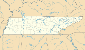
| Location in Tennessee | ||
|
|
||
| Basic data | ||
| State : | United States | |
| State : | Tennessee | |
| County : | Claiborne County | |
| Coordinates : | 36 ° 36 ′ N , 83 ° 40 ′ W | |
| Time zone : | Eastern ( UTC − 5 / −4 ) | |
| Residents : | 494 (as of 2010) | |
| Population density : | 617.5 inhabitants per km 2 | |
| Area : | 0.8 km 2 (approx. 0 mi 2 ) of which 0.8 km 2 (approx. 0 mi 2 ) is land |
|
| Height : | 396 m | |
| Postcodes : | 37724 and 37752 | |
| Area code : | +1 423 | |
| FIPS : | 47-18880 | |
| GNIS ID : | 1281829 | |
| Website : | townofcumberlandgap.com | |
Cumberland Gap is a municipality ( town ) in Claiborne County in the US state of Tennessee . It is named after the nearby Cumberland Gap . In 2010 the place had 494 inhabitants.
geography
The village is located south of the Cumberland Gap at 396 m above sea level and thus almost a hundred meters lower than the top of the pass. The northern border of the east also forms the border with the state of Virginia , the westernmost part of the municipality extends to near the border with Kentucky . The community is traversed by Gap Creek and has a size of around 0.8 km². The next major towns are Harrogate in the south and Middlesboro in Kentucky.
history
The village owes its existence to the Wilderness Road over the Cumberland Gap in the late 18th century . From 1775 to 1840, over 300,000 people used this early connection to the west. The settlement served primarily to supply these travelers, and a post office was set up in 1803. There was also a grain mill and iron smelter in Cumberland Gap.
During the Civil War , the Cumberland Gap was viewed by both sides as particularly strategically important. Although there never was actually any fighting, the pass changed occupiers several times, which also seriously affected the settlement below. However, the town had already lost its importance due to the construction of better located roads and railways and the associated decline in tourist traffic.
In the 1880s, English investors discovered the region's natural resources. While Middlesboro in Kentucky was to serve as the headquarters of the American Association, Limited , Cumberland Gap and Harrogate were planned as Company Towns in Tennessee . From 1886 to 1891, new streets and buildings replaced the old settlement. The company also built a railway line over the pass. However, the further development came to an abrupt end with the bankruptcy of the financing bank and a depression after the panic of 1893 .
In 1907 Cumberland Gap received the rights of a "town" and thus became an independent municipality. At the 1910 census, the place had 347 inhabitants. It experienced an upswing again in the 1920s with coal mining in the region and the construction of a modern highway . In 1940 409 inhabitants were registered, from the 1950s the population fell steadily. The reason for this was the general decline in mining and the relocation of the trunk road through a tunnel west of Cumberland Gap. In the 2000 census, the population reached a low of 204 people, but rose by over 140% in the following years, reaching the record level of 494 inhabitants. The construction of a student residential building by the Lincoln Memorial University from neighboring Harrogate was responsible for this .
Much of the historic center of Cumberland Gap has been listed as the Cumberland Gap Historic District since 1990. The district consists of almost 40 objects, the oldest of which from the late 19th century.
traffic
US Highway 25E , which once ran over the pass , has been running through the Cumberland Gap Tunnel since 1996 , the south portal of which is located immediately west of the town of Cumberland Gap. In the south of the community, US Highway 58 branches off from Highway 25E. A Norfolk Southern Railway line from Knoxville over the pass to Middlesboro runs through the parish. In contrast, the Louisville and Nashville Railroad line from Virginia was shut down and dismantled years ago.
Web links
- Official website of the municipality of Cumberland Gap ( English )
