Dahlak Archipelago
| Dahlak Archipelago | ||
|---|---|---|
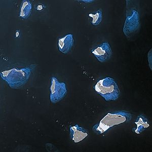
| Satellite image of the eastern part | ||
| Waters | Red Sea | |
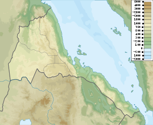
| Geographical location | 16 ° 0 ′ N , 40 ° 15 ′ E | |
|
|
||
| Number of islands | 126 | |
| Main island | Dahlak Kebir | |
| Total land area | 900 km² | |
| Residents | 2800 | |
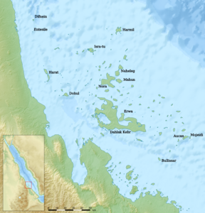
| Overview map of the Dahlak Archipelago | ||
The Dahlak Archipelago is a group of islands belonging to Eritrea in the Red Sea off Massaua . It forms the sub-region (district) Dahlak, one of nine sub-regions of the Semienawi Kayih Bahri region ( Northern Red Sea ). The archipelago comprises two larger islands ( Dahlak Kebir with 754.9 km² and Nora with 104.6 km²) as well as 124 small and smallest and is separated from the Eritrean mainland by the Massawa Channel, which is 14 km wide at its narrowest point .
Together the islands have an area of 900 square kilometers. Only the main island of Dahlak Kebir and two other islands ( Nora and Dehil ) are inhabited. A total of around 2800 people live on the islands, 2000 of them on the main island of Dahlak Kebir . The inhabitants of the archipelago speak their own language very similar to the Tigré , the Dahalik .
The islands are surrounded by coral reefs and are a paradise for divers because of their abundance of fish. They form the Dahlak Marine National Park , one of only two national parks in Eritrea.
history
The islands used to be the center of pearl fishing in the Red Sea, and they were probably already known to the Romans . The residents were among the first to become Muslims in East Africa . As early as the 7th century, an independent Islamic state was formed on the islands. But they soon came under Yemeni and in 1559 under Ottoman rule. At the beginning of the Italian colonial rule over Eritrea in 1891/92 there was a camp on one of the islands for opposition members from Eritrea and other Italian colonies. In the war of independence of Eritrea against Ethiopia , the use revived. During this time there was a naval base on the islands used by the Soviet Union , which was then briefly used by Israel during the dissolution of the Soviet Union in 1990–1991 .
According to a Stratfor report , Israel still has a "small but significant" naval and reconnaissance presence in the archipelago today.
The Grand Hotel Dahlak , which opened a few years ago, is located on the island of Dissei (Dessie), a coastal and traditionally inhabited island to the west (mainland) of the Massawa Channel and therefore no longer part of the Dahlak Archipelago.
Web links
- Gianni Roghi and Francesco Baschieri: Dahlak with the Italian National Underwater Expedition in the Red Sea (1957)
-
Topographic map of the General Staff of the USSR 1: 200,000 ( Russian )
- Map sheet E37-34 (northwest)
- Map sheet E37-35 (northeast)
- Map sheet D37-04 (southwest)
- Map sheet D37-05 (southeast)
- Map sheet D37-11 (south of southeast, due to reef)
swell
- ↑ Entry at Spiegel-Wissen , Wissen-Media Verlag, 2008 ( page no longer available , search in web archives ) Info: The link was automatically marked as defective. Please check the link according to the instructions and then remove this notice.
- ↑ israelnationalnews.com


