Dehil
| Dehil | ||
|---|---|---|
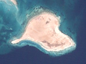
| LANDSAT image of the island | ||
| Waters | Red Sea | |
| Archipelago | Dahlak Archipelago | |
| Geographical location | 15 ° 54 '40 " N , 39 ° 38' 14" E | |
|
|
||
| length | 6.2 km | |
| width | 3 km | |
| surface | 11.28 km² | |
| Highest elevation | 53 m | |
| Residents | 473 (2009) 42 inhabitants / km² |
|
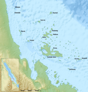
| Map of the Dahlak Archipelago with Dohul in the west | ||
Dehil even Dehel or Dohul transcribed , is next to Dahlak Kebir and Nora one of the three inhabited islands in to Eritrea belonging Dahlak archipelago in the Red Sea .
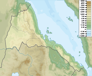
Dehil is located in the western part of the Dahlak Archipelago, around 21 kilometers northeast of the Eritrean mainland near Ras Harb, but 31 kilometers northwest of the main Dahlak island of Dahlak Kebir and 36 kilometers southwest of Nora, the third inhabited island in the archipelago.
According to the PNAS island database, Dehil (Dohul) has an area of 11.28 km². It reaches a height of 53 meters.
In 2009 the island had 473 inhabitants in 102 households.
The Dahalik language is spoken on the island as well as on Dahlak Kebir and Nora .
Administratively, like the entire archipelago, Dehil belongs to the Semienawi Kayih Bahri region .
Individual evidence
- ^ PNAS Islands Database
- ↑ Topographic map of the General Staff of the USSR 1: 200,000, map sheet D37-04 in Russian
- ↑ The Danish Society for the Living Sea: Clean drinking water for two island communities of Eritrea ( Memento of the original from August 9, 2014 in the Internet Archive ) Info: The archive link was automatically inserted and not yet checked. Please check the original and archive link according to the instructions and then remove this notice. (2011)
- ↑ Marie-Claude SIMEONE-Senelle: A survey of the Dahalik language language, to Afro-Semitic language spoken Exclusively in Eritrea (2005)


