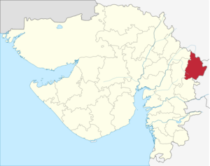
Dahod (District)
| Dahod District | |
|---|---|

|
|
| State | Gujarat |
| Administrative headquarters : | Dahod |
| Area : | 3,646 km² |
| Residents : | 2,126,558 (2011) |
| Population density : | 583.25 inhabitants / km² |
| Website : | dahod.nic.in |
Dahod ( Gujarati : દાહોદ) is a district in the western Indian state of Gujarat .
The district was separated from the Panchmahal district on October 1, 1997 . The area is 3,646 km². The administrative seat is the city of the same name Dahod .
population
The population is 2,126,558 (2011).
Web links
Commons : Dahod District - Collection of images, videos and audio files
Individual evidence
- ↑ 2011 census (PDF; 398 kB)
Coordinates: 22 ° 50 ′ 2 ″ N , 74 ° 15 ′ 28 ″ E
