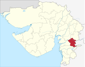
Narmada (district)
| Narmada District | |
|---|---|

|
|
| State | Gujarat |
| Administrative headquarters : | Rajpipla |
| Area : | 2,817 km² |
| Residents : | 590,297 (2011) |
| Population density : | 210 inhabitants / km² |
| Website : | [1] District website |
The district of Narmada ( Gujarati : નર્મદા જીલ્લો ) is one of 26 districts of the state of Gujarat in India . The city of Rajpipla is the capital of the district. The last census in 2011 showed a total population of 590,297 people.
history
From pre-Christian times, the area - like the entire region - was ruled by various Buddhist and Hindu rulers. The first civilization was the Indus culture . From 1350 to 1948 it was ruled by the Gohil Rajput dynasty. It was embroiled in military clashes with Muslim conquerors and rulers in northern India for centuries. Nevertheless, thanks to tribute payments, it remained as the Principality of Rajpipla . The tributes were paid first to the Sultanate of Gujarat and later to the Mughals . The Marathas had been attacking Muslim rule since the beginning of the 18th century . Rajpila paid tribute to them. After a brief occupation by Baroda State , it came under British rule. Rajpila State became an independent princely state within the British administrative region of the Bombay Presidency . With India's independence in 1947 and the reorganization of the country, it became part of the new state of Bombay in 1949 . In 1960 this Indian state was divided and the area came to the newly created state of Gujarat. The area of the district as it is today was created on October 2, 1997. For this purpose, 3 talukas (Nandod, Dediyapada and Sagbara) from the Bharuch district and 1 taluka (Tilakwada) from the Vadodara district were merged to form the new Narmada district.
population
Population development
As everywhere in India, the population in the Narmada district has been growing rapidly for decades. The increase in the years 2001–2011 was almost 15 percent (14.75%). In these ten years the population increased by around 76,000 people. The following table shows the exact numbers:

Significant places
The town with the largest population and the only town in the district is the main town of Rajpipla with around 35,000 residents. Other important places are Dediapada, Kevadiya, Selamba and Sagbara. The urban population makes up only 10.48 percent of the total population.

Web links
- Map of the Narmada District
- Narmada District
- Economy, nature and sights
- brief overview of the district
- 2001 census result for Narmada
- Narmada District Statistical Manual
Individual evidence
- ↑ 2011 census
- ^ History of the district up to 1900 in the Imperial Gazeteer Of India
- ^ Result of the 2011 census on city population
Coordinates: 21 ° 52 ' N , 73 ° 30' E
