Dammahütte
| Dammahütte SAC refuge |
||
|---|---|---|
|
Dammahütte from the south |
||
| location | at the foot of the moss ; Canton UR CH |
|
| Mountain range | Uri Alps | |
| Geographical location: | 678.02 thousand / 166470 | |
| Altitude | 2439 m above sea level M. | |
|
|
||
| owner | SAC Pilatus | |
| Construction type | Refuge | |
| Usual opening times | Early July to late September | |
| accommodation | 23 beds | |
| Web link | Website of the section | |
| Hut directory | SAC | |
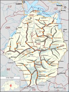
The Dammahütte is a mountain hut belonging to the Swiss Alpine Club (SAC), Pilatus section , in the canton of Uri ( Switzerland ). It is located on the south ridge of the Moosstock, east of the Dammastock and Dammagletscher at 2,439 m above sea level. M. in the Urner Alps and in a panoramic location with a deep view of the Göscheneralpsee . It offers 23 beds and is manned in the summer season from the beginning of July to the end of September.
history
The Dammahütte was exhibited by the SAC at the Bern National Exhibition in 1914, transported to its present location in 1915 and then set up again. The inauguration by the Pilatus Section took place in 1916. There is a water connection in the hut.
Approach
The hut path (marked white-red-white) leads from the dam (Postbus course from Göschenen ) along the north bank of the Göscheneralpsee via Vorder Röti-Egg to the hut in around 3 hours. The ascent along the south bank - only when there is no snow - takes about 2½ hours.
Tours
The area around the Dammahütte offers climbing tours of all levels of difficulty and is a suitable starting point for various high-altitude tours such as Dammastock East Rippe 3630 m above sea level. M. , Schneestock east edge 3608 m above sea level. M. , Eggstock, Rhonestock, Tiefenstock, Gletschhorn .
Crossings exist over the Dammajoch, Dammapass or Winterlücke and Rhone Glacier to the Furkapass (VS); over the Dammajoch to the Trifthütte (BE); over the winter gap to the Albert-Heim-Hütte (UR); Via Vorder Röti to the Kehlenalp or Bergseehütte (UR).
.
hazards
White-blue-white marked routes, glacier crossings or paths without markings should only be used by experienced and appropriately equipped mountaineers.
literature
- Maps: 1: 25,000 sheet 1231 Urseren, 1: 25,000 sheet 1231 Sustenpass
- Toni Fullin, Andi Banholzer: SAC Club Guide Urner Alpen 2


