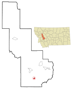
Deer Lodge
| Deer Lodge | |
|---|---|
 Aerial view of Deer Lodge |
|
| Location in Montana | |
| Basic data | |
| Foundation : | 1860 |
| State : | United States |
| State : | Montana |
| County : | Powell County |
| Coordinates : | 46 ° 24 ′ N , 112 ° 44 ′ W |
| Time zone : | Mountain ( UTC − 7 / −6 ) |
| Residents : | 3,421 (as of: 2000) |
| Population density : | 924.6 inhabitants per km 2 |
| Area : | 3.7 km 2 (approx. 1 mi 2 ) of which 3.7 km 2 (approx. 1 mi 2 ) are land |
| Height : | 1392 m |
| Postal code : | 59722 |
| Area code : | +1 406 |
| FIPS : | 30-19825 |
| GNIS ID : | 0782261 |
Deer Lodge is a town in Powell County , in the US state of Montana . The city has 3421 inhabitants (as of 2000) and an area of 3.7 km². Deer Lodge is located approximately 100 km southwest of Helena and 1418 m above sea level . The place is also the seat of the county administration ( County Seat ).
Attractions
The Grant-Kohrs Ranch National Historic Site is on the outskirts . It is the national memorial for the time of the Open Range at the end of the 19th century, when private ranchers let their herds graze unregulated on public land and driven by cowboys on the long cattle drives to the railroad. It emerged from the ranch of the "cattle baron" Conrad Kohrs and has been federally owned since 1972. The ranch is administered and actively operated by the National Park Service . Visitors can experience late 19th-century cattle farming and take part in living history demonstrations.
sons and daughters of the town
- Phil Jackson (* 1945), basketball player and coach, who coached the Chicago Bulls and Los Angeles Lakers won a total of eleven NBA championships.
- Jean Parker (1915–2005), actress
