Dehtář
| Dehtář | ||
|---|---|---|

|
||
| View from Holubovská Bašta to the Dehtář, on the left part of the island | ||
| Geographical location | Budweiser Basin ( Czech Republic ) | |
| Tributaries | Dehtářský potok , Babický potok, Kamenný potok | |
| Drain | Dehtářský potok | |
| Location close to the shore | České Budějovice | |
| Data | ||
| Coordinates | 49 ° 0 '25 " N , 14 ° 17' 53" E | |
|
|
||
| Altitude above sea level | 406 m | |
| surface | 2.46 km² | |
| volume | 6,500,000 m³ | |
| Maximum depth | 6 m | |
|
particularities |
wooded island |
|
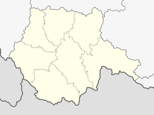
The Dehtář (German Dechtern pond ) is a pond in southern Bohemia. It is located 14 kilometers west of the city of České Budějovice in the Budweiser Basin in the Czech Republic and is one of the ten largest ponds in the country.
geography
The Dehtář is located in the area of the municipality Žabovřesky in the Okres České Budějovice and belongs to the cadastral district Dehtáře . The pond dammed up immediately west of the village Dehtáře by a 234 m long and ten meter high earth dam is fed by the Dehtářský creek and its tributaries Babický potok and Kamenný potok .
To the south, separated by a narrow land bridge, there is another, much smaller pond, Posměch , whose outflow, the Kamenný potok , flows into the Dehtář . To the north rises the Na Středním ( 441 m ), in the southeast of the Vosí vrch ( 441 m ) and west of the Zádušní vrch ( 454 m ). The villages of Dehtáře , Holubovská Bašta , Záboří , Strýčice , Radošovice and Tupesy are located around the pond .
In the southern part of the pond there is a wooded island. It is connected to the land bridge at Holubovská Bašta by a footbridge . Ducks are raised on the island.
The peninsula protruding into the Dehtář on the northwestern bank used to be the second island.
history
The artificial fish pond created at the confluence of the Furlbach and the Dechternbach at the instigation of Wok II. Von Rosenberg was flooded in 1479 and filled five years later. As compensation for the monastery village of Hummo flooded by the pond, Wok transferred the villages of Chuděgowitz and Girička to the Hohenfurth monastery in 1484 .
Web links
Individual evidence
- ↑ http://www.jiznicechy.org/cz/index.php?path=ost/dehtar.htm
- ^ Johann Gottfried Sommer The Kingdom of Bohemia, Vol. 9 Budweiser Kreis, 1840, p. 268
