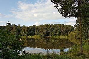
Delmegrundsee
| Delmegrundsee | ||
|---|---|---|

|
||
| View of the Delmegrundsee | ||
| Geographical location | Delmenhorst , Lower Saxony | |
| Places on the shore | Delmenhorst | |
| Data | ||
| Coordinates | 53 ° 2 '9.8 " N , 8 ° 36' 55.8" E | |
|
|
||
| surface | 3.5 ha | |
| length | 200 m | |
| width | 200 m | |
|
particularities |
||
The Delmegrundsee (on site also Mili or Milli called shorthand for military bathhouse ) is a quarry pond south of the city Delmenhorst , Lower Saxony . The Delme flows past the lake .
The lake was created in 1936 when the area belonged to the Delmenhorst-Adelheide military airfield and a lake was dug for this purpose, the banks of which were then lined with concrete. The resulting bathing establishment was used by Wehrmacht soldiers until April 1945. After 1945 the area and with it the lake was made accessible to the general public again. Until 1968 the lake was used as a public bathing establishment and operated by the Arbeiterwohlfahrt (AWO).
Today the lake is managed by the fishing association Delmenhorst e. V. used as fishing water from 1896. In 2009, out of the lake eel , perch , bream , white bream , pike , carp , rainbow trout , roach , rudd , tench and catfish reported.
See also
Web links
- Fischereiverein Delmenhorst e. V .: Delmegrundsee "Mili"
- anglermap.de: Delmegrundsee water profile

