Line
| Line | ||
|---|---|---|
|
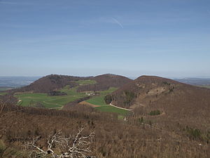
The row: on the left side peak with transmitter, in the middle of the picture the highest point. To the right of the asper's row. |
||
| height | 867 m above sea level M. | |
| location | Kanton Aargau | |
| Mountains | law | |
| Dominance | 4.15 km → Räbenchopf | |
| Notch height | 193 m ↓ Bänkerjoch | |
| Coordinates | 645 104 / 255607 | |
|
|
||
The Strihe (also Strihen or Densbürer Strihen ) is an 867 m above sea level. M. high mountain in the Aargau Jura .
It is considered to be the highest mountain in the canton of Aargau. This is not the highest point in the canton, which is located on the Geissfluegrat at 908 meters , nor the highest peak in the canton, which is 872 meters on the Stierenberg . Both the Strihe and the neighboring Asperstrihe are in the area of the municipality of Densbüren .
photos
Individual evidence
- ↑ Swisstopo: map viewer . Retrieved September 3, 2015.
- ^ Roman Koch : Summit directory: Strihen . Archived from the original on April 21, 2008. Retrieved November 29, 2009.
- ↑ a b Canton of Aargau: Jubilee honors for highest Aargau mountain . December 20, 2003. Retrieved November 27, 2009.
- ↑ Aargau hiking trails: canton anniversary . Archived from the original on January 31, 2009. Info: The archive link was inserted automatically and has not yet been checked. Please check the original and archive link according to the instructions and then remove this notice. Retrieved November 27, 2009.
- ↑ Thomas Widmer: Chance leads to the lines . In: Tages-Anzeiger . Retrieved November 27, 2009.


