Derby (Connecticut)
|
|
This article was on the basis of substantive defects quality assurance side of the project USA entered. Help bring the quality of this article to an acceptable level and take part in the discussion ! A closer description on the resolving issues is missing. |
| Derby | ||
|---|---|---|
 seal |
 flag |
|
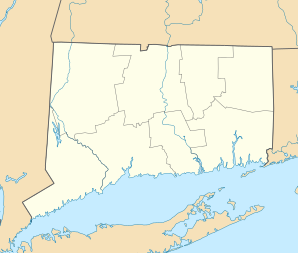
| Location in Connecticut | ||
|
|
||
| Basic data | ||
| Foundation : | 1675 | |
| State : | United States | |
| State : | Connecticut | |
| County : | New Haven County | |
| Coordinates : | 41 ° 20 ′ N , 73 ° 5 ′ W | |
| Time zone : | Eastern ( UTC − 5 / −4 ) | |
| Residents : | 12,903 (as of 2010) | |
| Population density : | 1,000.2 inhabitants per km 2 | |
| Area : | 14.0 km 2 (approx. 5 mi 2 ) of which 12.9 km 2 (approx. 5 mi 2 ) are land |
|
| Height : | 31 m | |
| Postal code : | 06418 | |
| Area code : | +1 203 | |
| FIPS : | 09-19480 | |
| GNIS ID : | 0206671 | |
| Website : | www.lnvalley.org/derby/ | |
| Mayor : | Anita Dugatto | |
Derby is a city in New Haven County in the US state of Connecticut , United States . The metropolitan area has a size of 13.9 km², making the city the smallest city in Connecticut by area.
history
After the area was settled by various Indian tribes, the area of what is now Derby was visited by various New Haven merchants until a trading post was established in 1642. The first permanent huts were finally built around 1651. The city later became important for agriculture, so the first water mill in the city was opened in 1681. Later the Housatonic River was used for merchant shipping, from which the city could benefit. When the Housatonic Dam, a dam, opened near the city in 1870, the city's industrial boom began, as it now had a source of energy.
sons and daughters of the town
- William Hull (1753–1825), politician and officer in the American War of Independence and the War of 1812
- Samuel G. Andrews (1796–1863), politician
- David Raymond Curtiss (1878-1953), mathematician
- Patrick B. O'Sullivan (1887–1978), politician
- Nick Pietrosante (1937–1988), American football player
- Richard A. Brualdi (* 1939), mathematician

