Dommerberg
| Dommerberg | ||
|---|---|---|
|
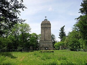
The Dommerberg with the Bismarck Tower (2016) |
||
| height | 263.6 m above sea level NHN | |
| location | Hessen , Germany | |
| Mountains | Odenwald | |
| Coordinates | 49 ° 50 ′ 40 " N , 8 ° 40 ′ 47" E | |
|
|
||
| rock | Crystalline Odenwald - Frankenstein Complex | |
| Age of the rock | about 360 million years | |
| particularities | Bismarck Tower ( AT ) | |
The Dommerberg is a 263.6 m above sea level. NHN high mountain in the north-west of the Odenwald and about 2 km southeast of the city center of Darmstadt in Hesse . It is the highest point in the Darmstadt area. The mountain is heavily forested.
Etymology and history
In a floor plan from 1724 in Landgrave Ludwig VIII's hunting atlas , the height is called "Tumme". In the course of time it became "Tummesberg" and later "Dommerberg". The meaning of the name is unclear.
Others
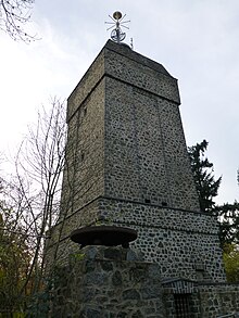
The Bismarck Tower is on the mountain .
See also
Web links
Individual evidence
- ↑ Map services of the Federal Agency for Nature Conservation ( information )
- ^ Magistrate of the City of Darmstadt
- ^ Wilhelm Andres: Name book of the Darmstadt forest paths. Reba-Verlag GmbH, Darmstadt 1995, p. 40f.


