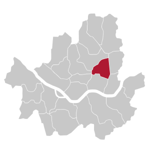
Dongdaemun-gu
|
Dongdaemun-gu 동대문구 municipality of Seoul |
|
|---|---|
| Coordinates | 37 ° 34 '16 " N , 127 ° 0' 35" E |
| surface | 14 km² |
| Residents | 386,433 (2006) |
| Population density | 27,602 inhabitants / km² |
Dongdaemun-gu (동대문구) is one of the 25 districts of Seoul and is located north of the Han River . It is named after the Dongdaemun city gate , which is part of the Jongro district in today's district boundaries .
history
The area of today's Dongdaemun district was originally outside the city walls of Seoul, east of the Dongdaemun city gate and on the way from Seoul over the Salgoji Bridge to Kangwonland and the southern provinces. The area was used for agriculture during this time. Taejo , the founder of the Joseon Dynasty , was buried here, which also gave the area a spiritual meaning.
The modernization of the previously agricultural area began at the end of the 19th century. From 1899, the first Korean tram went to Cheongnyangni . Construction of Cheongnyangni Station began in 1911, and Seongdeong Station began construction in 1939 . In 1925, the Jongyeon spinning mill started operations .
The current city district was founded in 1943, at that time it covered a slightly larger area than today.
The post-war period, and in particular the 1960s and 1970s, saw an extraordinary population explosion and associated construction activity, even by Seoul standards.
Districts
Dongdaemun-gu consists of 14 dongs .
- Cheongnyangni-dong
- Dapsimni 1-dong
- Dapsimni 2-dong
- Hoegi-dong
- Hwigyeong 1-dong
- Hwigyeong 2-dong
- Imun 1-dong
- Imun 2-dong
- Jangan 1-dong
- Jangan 2-dong
- Jegi-dong
- Jeonnong 1-dong
- Jeonnong 2-dong
- Yongsin-dong
Universities
Research institutes
Attractions
- Gyeongdong Market (medicinal herbs and ginger)
- Sejong Memorial in Hongneung
The Dongdaemun Market and the Dongdaemun History & Culture Park are located in the neighboring Jongro District .
Individual evidence
- ^ Gate of Seoul: Dongdaemun-gu


