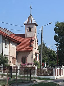
Drulity
Drulity (German Draulitten ) is a Polish village in the Warmian-Masurian Voivodeship . The village in the former East Prussia belongs to the municipality of Gmina Pasłęk ( Prussian Holland ).
geography
Drulity is located in the northwest of the Warmian-Masurian Voivodeship, about 50 kilometers as the crow flies from the Baltic Sea , at an altitude of 115 meters above sea level. The center of the municipality of Pasłęk is 15 kilometers away and can be reached via the 526 Myślice (Miswalde) - Pasłęk road. Two kilometers to the west is the Oberland Canal , where the Buczyniecer Forest begins, a 15 km² forest area. A caravan parking space was created on the canal bank .
history
According to sources, Drulity goes back to the Draulitten manor, which already existed in the 16th century , which at that time belonged to the property of the Prussian Duke Albrecht . The estate later passed to the von Wallenrodt family , whose members remained owners until 1787. The von Starke family was then landowners on Draulitten until 1825. When the estate was sold to Johann von Banwels in 1825, he drove the property into ruin. He had the manor forest cut down and the farm buildings to decay. After a foreclosure auction and a brief interlude with the von Besser family , the Hamburg merchant Jürgen Sthamer finally acquired Gut Draulitten in 1851.
Sthamer led the estate back into profitability, among other things he ran a merino sheep farm . In 1855 he built a representative mansion on the estate, which was built in the so-called Hamburg style. A two-storey plastered building was created with central projections on both main fronts. The pointed roofs of the risalits reached the ridge height of the gable roof closing off the main building . On the garden side, a wooden veranda was added to the entire width of the risalit, the front of which was divided into seven windows. The garden was designed by the Berlin horticultural master Lintrop.
At that time Draulitten was ruled by the Kingdom of Prussia . After the administrative reform of 1815, it was incorporated into the Prussian Holland district as an administratively independent manor district . After administrative districts were formed in 1874 , the manor district became part of the Dargau district. In 1910 there were 195 residents on Gut Draulitten. When the autonomy of the manor districts was abolished in 1928, the two Sthamerschen manor districts of Draulitten and Tompitten merged to form the new rural community of Draulitten, with a population of 232 in 1933.
Jürgen Sthamer died in the year the mansion was built. Rinderpest broke out shortly afterwards and destroyed all livestock. Jürgen Sthamer's heir, Emil Sthamer, died four years after taking over the estate in 1859. However, Draulitten remained in the family's possession until the beginning of the 20th century. After the construction of the Oberland Canal, the estate ran into economic difficulties again, as large areas of grassland were flooded as a result of the canal construction. On the other hand, with the expansion of the Preussisch Holland - Miswalde road, which passed Draulitten three kilometers away, the estate was connected to the East Prussian road network in the 1890s and thus strengthened economically.
At the beginning of the 20th century, the Krahmer family took over Gut Draulitten. The conversion of the manor house went hand in hand with the change of ownership. A higher mansard roof was put on and all wooden elements were replaced. A balcony supported by four columns was placed in front of the central projection of the front facade. Its elaborate balustrade was decorated with four stone vases and pedestals . The last German landowner was Hans Werner Krahmer. At the end of the Second World War , the Red Army conquered the area around Draulitten at the end of January 1945 and the population fled west.
After the war the village came under Polish administration and was renamed Drulity . With the administrative reorganization of Poland, the village was assigned to the Olsztyn Voivodeship . The manor became a state estate, the management of which was housed in the former manor house, which also served as a residential building. During the 1980s, the manor house was renovated. After 1990 the estate was privatized and the manor house was also given into private hands. The new owners carried out another renovation of the house in the mid-1990s, during which, among other things, the roof was renewed. As of 2011, Drulity is located in the Warmian-Masurian Voivodeship, is administered by the Powiat elbląski (Elbing) district and belongs to the municipality of Gmina Pasłęk. In 2006 Drulity had 410 residents.
literature
- Mirosław Garniec: Castles and manor houses in the former East Prussia. Studio Arta Olsztyn 2001, ISBN 83-912840-3-4 , pp. 43/44.
Web links
- Draulitten in the Duncker Collection (PDF file; 264 kB)
- Draulitten at ostpreussen.net
- District Dargau / Awecken
- Michael Rademacher: German administrative history from the unification of the empire in 1871 to the reunification in 1990. prholland.html. (Draulitten; online material for the dissertation, Osnabrück 2006).
Coordinates: 53 ° 58 ′ 16.7 " N , 19 ° 38 ′ 30.8" E


