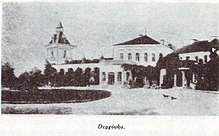
Dsyhiwka
| Dsyhiwka | ||
| Дзигівка | ||

|
|
|
| Basic data | ||
|---|---|---|
| Oblast : | Vinnytsia Oblast | |
| Rajon : | Jampil district | |
| Height : | 135 m | |
| Area : | 8.196 km² | |
| Residents : | 4,132 (2001) | |
| Population density : | 504 inhabitants per km² | |
| Postcodes : | 24531 | |
| Area code : | +380 4336 | |
| Geographic location : | 48 ° 21 ' N , 28 ° 19' E | |
| KOATUU : | 0525682201 | |
| Administrative structure : | 2 villages | |
| Address: | вул. Леніна буд. 15 24531 с. Дзигівка |
|
| Website : | Website of the district council | |
| Statistical information | ||
|
|
||
Dsyhiwka ( Ukrainian Дзигівка ; Russian Дзыговка Dsygowka , Polish Dzygówka ) is a village in the south of the Ukrainian Vinnytsia Oblast with about 4100 inhabitants (2001).
Dsyhiwka is the administrative center of the eponymous, 8.473 km² district council in the center of Jampil Rajon , to which the village of Djubrowe ( Дзюброве , ⊙ ) with about 40 inhabitants belongs.
The village is located on the bank of the 30 km long Korytna ( Коритна ) 17 km north of the district center Jampil , 10 km southwest of Klembivka and 120 km south of the oblast center Vinnytsia . The regional road P – 08 runs east of the village .
The village was founded in the early 18th century. In 1734 the villagers joined the Hajdamak uprising .
Web links
Commons : Dsyhiwka - collection of images, videos and audio files
- Municipal Council website (Ukrainian)
- Dzygówka . In: Filip Sulimierski, Władysław Walewski (eds.): Słownik geograficzny Królestwa Polskiego i innych krajów słowiańskich . tape 2 : Derenek – Gżack . Sulimierskiego and Walewskiego, Warsaw 1881, p. 312 (Polish, edu.pl ).
- Dzygówka . In: Filip Sulimierski, Władysław Walewski (eds.): Słownik geograficzny Królestwa Polskiego i innych krajów słowiańskich . tape 1-15, (1880-1902) . Walewskiego, Warsaw, p. 468 (Polish, edu.pl ).
Individual evidence
- ↑ Local website on the official website of the Verkhovna Rada ; accessed on October 21, 2017 (Ukrainian)
- ^ Website of the district council on the official website of the Verkhovna Rada; accessed on October 21, 2017 (Ukrainian)
- ↑ history Dsyhiwka in the history of the towns and villages of the Ukrainian SSR ; accessed on October 21, 2017 (Ukrainian)


