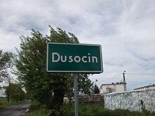
Dusocin
Dusocin ( German 1772–1903 Dossoczyn , Dossenzien ; also Doszoczyn and Doßoczyn , 1903–1920 / 1939–1945 Schöntal ) is a village in the rural community Grudziądz in the powiat Grudziądzki of the Polish Kujawy-Pomeranian Voivodeship .
Geographical location
The village is located in the former West Prussia, south of the Gdańsk Bay , halfway between the villages of Grudziądz (Graudenz) and Gardeja (Garnsee) , about seven kilometers northeast of Graudenz.
history
In a document pertaining to the possession of the knight Dietrich von Stange, the Orr was mentioned in 1285 showerzin ; other place names that were in use for the village are Duschexin , Ubitz , Uswitz , Auswitz , Auschwitz , Duscocino and Dussocin . In the place there was an outer courtyard of the Commandery of the Order Commandery Graudenz . After the fall of the rule of the Teutonic Order, the village came under Polish suzerainty in 1454. It belonged to the autonomous Prussian royal share and was a border village between West Prussia and East Prussia.
Through the first partition of Poland-Lithuania in 1772, western Prussia with the district of Graudenz and Dossoczyn under Frederick II of Prussia was reunited with the eastern part of the Kingdom of Prussia to the extent that these parts were connected with each other at the time of the Teutonic Order . In 1789 Dossenzien is referred to as a royal village with 37 fireplaces (households), which belongs to the Graudenz domain office.
From 1818 to 1920 the village belonged to the district of Graudenz in the province of West Prussia of the German Empire . In 1903 the new place name Schöntal was introduced.
After the First World War , Schöntal had to be ceded to Poland due to the provisions of the Versailles Treaty in 1920 for the establishment of the Polish Corridor with the entire district of Graudenz . Due to the attack on Poland in September 1939, the district was annexed by the German Reich in violation of international law and was now assigned to the Reichsgau Danzig-West Prussia , to which Schöntal belonged until 1945.
Towards the end of the Second World War , the Red Army occupied the region in the spring of 1945 . As far as the German minority did not flee, they were expelled in the following time.
Population numbers
| year | Residents | Remarks |
|---|---|---|
| 1832 | 409 | in 65 houses |
| 1852 | 543 | |
| 1864 | 612 | including 537 Protestants and 53 Catholics |
| 1905 | 485 |
literature
- Johann Friedrich Goldbeck : Complete topography of the Kingdom of Prussia . Part II: Topography of West Prussia , Marienwerder 1789, p. 37, no. 7.) .
- Xaver Frölich : History of the Graudenzer Kreis . Volume 1, Graudenz 1868, pp. 67-69.
Web links
Footnotes
- ^ A b Xaver Frölich : History of the Graudenzer Kreis . Volume 1, Graudenz 1868, pp. 67-69.
- ^ Johann Friedrich Goldbeck : Complete topography of the Kingdom of Prussia . Part II: Topography of West Prussia , Marienwerder 1789, p. 37, no. 7.) .
- ^ Johann Friedrich Goldbeck : Complete topography of the Kingdom of Prussia . Part II: Topography of West Prussia , Marienwerder 1789, Third main part: Complete topography of the West Prussian Cammer Department , p. 43.
- ↑ Handbook to the Atlas of Prussia in 27 maps . Volume 1, Müüler, Erfurt 1835, p. 723, first line.
- ^ Kraatz: Topographical-statistical manual of the Prussian state '. Berlin 1856, p. 127.
- ^ E. Jacobson: Topographical-statistical manual for the administrative district Marienwerder . Danzig 1868, local directory of the Marienwerder administrative district , pp. 18–19, no. 39.
- ↑ http://wiki-de.genealogy.net/GOV:SCHTALJO93KN ( page no longer available , search in web archives ) Info: The link was automatically marked as defective. Please check the link according to the instructions and then remove this notice.
Coordinates: 53 ° 35 ' N , 18 ° 52' E
