
East Ryde
| East Ryde | |||||||||
|---|---|---|---|---|---|---|---|---|---|
 Lane Cove River in East Ryde |
|||||||||
|
|||||||||
|
|||||||||
|
|||||||||
|
|||||||||
|
|||||||||

East Ryde is a suburb of Sydney in Australia . It belongs to the northern suburbs and is 12 km northwest of Sydney city center. It belongs to the Ryde City Local Government Area . East Ryde is on the west bank of the Lane Cove River . Together with the neighboring district of North Ryde it has the zip code of 2113.
Townscape
East Ryde is a relatively small, quiet suburb, surrounded on three sides by scrubland and water. Most of the suburb is on a large hill. The districts on the banks of the Lane Cove River lie above the mangrove swamps and are characterized by large, modern houses (mainly on Pittwater Road).
history
The entire area was once a turpentine and ironbark eucalyptus forest . At the end of the 1950s it was used as a garbage dump for the community, but then backfilled, leveled and developed into a new district. Originally called North Ryde Dress Circle Estate , it was part of North Ryde. But then it became a separate suburb of East Ryde.
In July 2006, a number of residents tried unsuccessfully to change the place name again in order to raise land prices. Suggestions were Melba, Dress Circle, Boronia Heights, Bennelong and Wallumatta. The movement was eventually stopped at a public meeting at which around 75% of East Ryde residents in attendance voted to keep the name.
Great North Walk
In the 1980s, a long distance footpath from Sydney to Newcastle called the Great North Walk was created. The trail partially follows the Lane Cove River and traverses East Ryde between Buffalo Creek and Magdala Park. Well-known attractions in the area include the mangroves at Buffalo Creek and Kittys Creek , where paved paths have been built to allow walking through the mangroves. There is a picnic area in the Buffalo Creek Conservation Area.
schools
The Ryde East Primery School , a primary school, located in the Twin Road and has about 350 students.
Gallery images
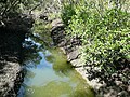
Kittys Creek with mangroves
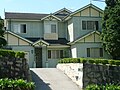
California style home on Coxs Road

Christian Reformed Church on Coxs Road

Weatherboard Home on Cressy Road


Individual evidence
- ^ Australian Bureau of Statistics : East Ryde ( English ) In: 2016 Census QuickStats . June 27, 2017. Retrieved April 30, 2020.
- ^ Ryde-ing into Bel Air , Daily Telegraph (Australia, 2006)
- ^ Neil Paton: Sydney and Blue Mountains Bushwalks . Kangaroo Press (2004). Pp. 24-25