Lane Cove River
| Lane Cove River | ||
|
Lane Cove River |
||
| Data | ||
| location | New South Wales , Australia | |
| River system | Parramatta River | |
| Drain over | Port Jackson → Tasman Sea | |
| source | at Thornleigh 33 ° 44 ′ 39 ″ S , 151 ° 5 ′ 27 ″ E |
|
| muzzle | At Woolwich in Sydney Harbor Coordinates: 33 ° 50 ′ 41 ″ S , 151 ° 10 ′ 43 ″ E 33 ° 50 ′ 41 ″ S , 151 ° 10 ′ 43 ″ E |
|
| Mouth height |
0 m
|
|
| length | 15 km | |
The Lane Cove River is a tributary of the Parramatta River in New South Wales , Australia . Its lower course forms an arm of Sydney Harbor .
description
The Lane Cove River has its source near Thornleigh and flows approximately 15 km in a mostly southern direction. The upper course lies in a narrow, wooded valley that has dug into the North Shore Plateau . The middle course is dammed by a weir above the Fullers Bridge . The valley is densely forested in places and part of Lane Cove National Park with a total area of 598 hectares, which was previously classified as a State Recreation Area .
The lower reaches of the Lane Cove River - below the weir at Fullers Bridge - is an estuary and flows into Sydney Harbor at Greenwich and Woolwich . There are significant settlements of mangroves on the banks of the lower reaches .
On January 1st, 1963, Dr. Gilbert Bogle and Margaret Chandler mysteriously to death. The case was never solved and is still known today as the Bogle-Chandler case .
A popular tent and caravan site, Lane Cove Tourist Park , is on the western slope of the valley above the river.

Great North Walk
There are many ancient paths and trails along the Lane Cove River, some of which date back to the time of European settlement. Today they are used as hiking trails. Several of them were integrated into the Great North Walk . This long-distance hiking trail leads from Sydney to Newcastle . It runs between Boronia Avenue in Hunters Hill and the Thornleigh Oval in Thornleigh along the Lane Cove River.
Fairyland
From 1913 to the 1970s, the Swan family ran a picnic area called Fairyland on the banks of the river above Epping Road. The site was originally a market garden, but the family turned it into a picnic area when they discovered the income opportunities it offered. The area has since been renatured and incorporated into Lane Cove National Park.
Harry Smith
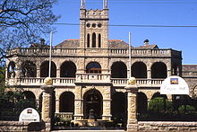
Harry Smith was a businessman who owned land in what is now Marsfield . Smith created a picnic area on the banks of the river, which has long since been renatured. But you can still see some stone steps on the slopes above the river at Culloden Road. Presumably Smith had built these steps to access his picnic area. He also owned a quarry nearby, which is where he obtained the stones for his mansion, Curzon Hall . This was built around 1899 and is at the intersection of Balaclava Road and Aigncourt Road. The name Curzon Hall was derived from the maiden name of Smith's wife. The building served various purposes over the years and is now an administration building. It is listed on the New South Wales Monument Register.
bridges
There are only four bridges over the Lane Cove River:
- De Burghs Bridge on Metroad 3 , which runs from North Ryde to West Pymble .
- Fullers Bridge on State Route 29 , which connects Chatswood to North Ryde.
- Epping Road ( State Route 28 ), which runs from Lane Cove to Ryde and also takes traffic from the M2 Hills Motorway .
- Fig Tree Bridge on Burns Bay Road connecting Lane Cove West to Hunters Hill .
See also
Web links
- Lane Cove River in the Open Directory Project
- Lane Cove National Park website website
- Lane Cove River Tourist Park Campground and Caravan Park website
Individual evidence
- ^ Gregory's Sydney Street Directory . (2002). Cards 221, 251, 252, 253, 283, 313 and 314
- ↑ Guide to New South Wales National Parks . National Parks and Wildlife Service of New South Wales (2002). P. 34
- ^ Neil Paton: Sydney and Blue Mountains Bushwalks . Kangaroo Press (2004). Pp. 5-30
- ↑ New South Wales Monument Register (English)


