
Eastry
| Eastry | ||||
|---|---|---|---|---|
|
 St Mary the Virgin Church |
|||
| Basic data | ||||
| status | Village and Civil Parish | |||
| surface | 10.80 km² | |||
| population | 2492 (as of 2011) | |||
| Ceremony county | Kent | |||
| District | Dover District | |||
| Constituency | Dover | |||
| Website: eastry-pc.gov.uk | ||||

Eastry is a village and a civil parish in the Dover District of the English county of Kent with around 2,500 inhabitants (as of 2011).
geography
Eastry is in a flat landscape about eight miles north of Dover and nine miles east of Canterbury .
history
Prehistoric settlement of the Eastry landscape is attested by Bronze Age barrows . Eastry is on a Roman road from Richborough to Dover, the modern main street Eastry High Street follows its course. At the time of the Anglo-Saxons , the place was the royal seat, the location of the palace is assumed in today's center. Numerous graves from Anglo-Saxon times testify to the importance of the place in what was then the Kingdom of Kent . In documents from the 9th century, the place is referred to as Eastorege , Eastergege and Easteraege , an Old English combination of easter for east and gē for region, district (same root as Gau ).
At the time of the Domesday Book , Eastry was such a significant place that the entire Lest de Eastreia ( Lathe of Eastry ) county was named after it.
Next to the church of St. Mary the Virgin there is a manor house , both buildings date back to the 12th century. Thomas of Canterbury is said to have hidden in the house for eight days on his escape in 1164 before sailing from Sandwich to France on November 11th .
photos
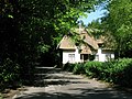
Thatched house

Puddle Dock Cottage

Former windmill, now a residential building


Web links
- Eastry Parish on kent-opc.org
Individual evidence
- ^ Martin Welch: Report on Excavations of the Anglo-Saxon Cemetery at Updown, Eastry, Kent . In: Sally Crawford, Helena Hamerow (Ed.): Anglo-Saxon Studies in Archeology and History . tape 15 . Oxbow Books, 2008, ISBN 978-1-78297-529-8 ( limited preview in Google Book Search).
- ↑ Edward Hasted: Parishes: Eastry . In: The History and Topographical Survey of the County of Kent . Volume 10. W Bristow, Canterbury 1800, pp. 98-121 (English, online on British History Online).
Coordinates: 51 ° 15 ' N , 1 ° 18' E