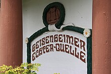
Real source
The real spring on the banks of the Rhine between Geisenheim and Rüdesheim was opened up in 1912 during the construction of the Hindenburg bridge. A hole 20 cm in diameter was dug to a depth of 24 m. It is highly mineralized , thermal groundwater that flows in a layer of groundwater- conducting quartz gravel . The name of the spring , which was formerly located in the area of Count Ingelheim, was at times Imperial Count von Ingelheim's Echterquelle , named after Prince-Bishop Julius Echter von Mespelbrunn . In the fountain pavilion , an alliance coat of arms of the von Ingelheim / Echter von Mespelbrunn families adorns the spring outlet .
The spring pavilion is open to the Rhine and rests on four columns.
At times the well is artesian .
Drilled layers THEWS 1977
| rock | Depth and terrain | Geological age |
|---|---|---|
| 7.4 m | Sand and gravel | Pleistocene |
| 17.76 m | Marl and clay mostly gray-green | Tertiary |
| 19.00 m | Quartz gravel, white, artesian overflow | Tertiary |
| 20.5 m | Clay, blue-gray, sandy | Tertiary |
| 24.5 m | Quartz gravel, white, light gray and gray green e.g. T. clayey | Tertiary |
Water sample March 28, 2007
| Cations | 1951 | 2007 | Anions | 1951 | 2007 |
|---|---|---|---|---|---|
| sodium | 928 | 651 | chloride | 277 | 200 |
| magnesium | 29 | 13 | Bicarbonate | 427 | 464 |
| Calcium | 75 | 34 | sulfate | 1220 | 660 |
Web links
Individual evidence
Coordinates: 49 ° 58 ′ 42.31 " N , 7 ° 57 ′ 11.38" E


