Einbach (Isar)
| Einbach | ||
|
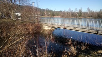
The river flows into the Isar reservoir Tölz |
||
| Data | ||
| location | Upper Bavaria | |
| River system | Danube | |
| Drain over | Isar → Danube → Black Sea | |
| source | below the Wackersberger Alm 47 ° 43 '56 " N , 11 ° 30' 49" E |
|
| Source height | 1122 m | |
| muzzle |
Isar coordinates: 47 ° 45 ′ 51 ″ N , 11 ° 32 ′ 35 ″ E 47 ° 45 ′ 51 ″ N , 11 ° 32 ′ 35 ″ E |
|
| Mouth height | approx. 640 m | |
| Height difference | approx. 482 m | |
| Bottom slope | approx. 82 ‰ | |
| length | approx. 5.9 km | |
The Einbach is a left tributary of the Isar in the municipality of Wackersberg in the Upper Bavarian district of Bad Tölz-Wolfratshausen . It feeds itself from numerous ditches on the eastern slopes of Zwiesel and Blomberg , flows largely northwards past the Dachshöhle natural monument to Oberfischbach and there flows into the Isar reservoir Tölz .
