Einsberg
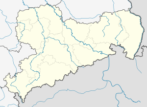
The location of the Einsberg in Saxony
|
The Einsberg is a 1003.2 m above sea level. Geographical object located above sea level on an unmarked ridge near Tellerhäuser in the Saxon Ore Mountains .
Geographical location
The Einsberg is north of Tellerhäuser and can be reached from there or from Höllgrund on steep forest aisles. Contrary to its name and the exposed location, the Einsberg is neither a summit nor a mountain , but a specified location ( geo-object ) on a ridge. It is located in one of the largest contiguous forest areas in Saxony. The Klöppelstraße, a paved forest path, leads over the ridge of the Einsberg.
geology
The Einsberg consists of mica- bearing albite phyllites in which basalt settles in two forms. In addition to low-olivine leucite basalt , which contains titanium nugite , fine-grained olivine , augite , magnetite , leucite and apatite , there is nepheline basalt , which in addition to titanium nugite also contains magnetite and apatite.
history
The name of the mountain comes from the time when Matthias Oeder measured and divided the extensive forest area on the Fichtelberg at the end of the 16th century. In the division from the Pfahlberg into ten curves and twelve main wings, Einsberg is located in the eponymous first main wing, which, according to Christian Lehmann, ran " after the broken man to Teller's new home ". The field name Geräderter Mann can already be found on the Oederschen map sheet of this area from around 1600 .
On the miles sheets created at the end of the 18th century under the direction of Friedrich Ludwig Aster , the ridge is not yet referred to as Einsberg, but as the Golden Height. This suggests that the name Einsberg did not come about until the 19th century. The first main wing is now known as Pfahlstraße and Steinweg. The Pöhlwassertal circular hiking trail leads for a part along this main wing.
On July 29, 2005, a tornado destroyed large parts of the approximately 70-year-old spruce stand on Einsberg.
A street in Tellerhäuser was named after the ridge on Am Einsberg .
Individual evidence
- ↑ From Annaberg to Oberwiesenthal (= values of the German homeland . Volume 13). 1st edition. Akademie Verlag, Berlin 1968, p. 164f.
- ^ Christian Lehmann: Historischer Schauplatz ... 1699, p. 128ff.
- ↑ Otto Birke: The district of Annaberg in the light of cartography of the 16th and early 17th centuries and associated files. 1913, p. 54
- ↑ Sächsische Meilen Blätter, Berlin copy, No. 344
- ↑ Land Surveying Office Saxony: Hiking map of Saxony 1:25 000 , sheet 16, Westerzgebirge Kurort Oberwiesenthal, 1st edition 1996
Coordinates: 50 ° 26 ′ 21 ″ N , 12 ° 53 ′ 58 ″ E
