Elaho River
| Elaho River | ||
|
View of the river valley of the Elaho River; lower right the Sims Creek |
||
| Data | ||
| location | British Columbia ( Canada ) | |
| River system | Squamish River | |
| Drain over | Squamish River → Howe Sound | |
| origin |
Elaho Glacier in the Pacific Ranges 50 ° 30 ′ 36 ″ N , 123 ° 41 ′ 40 ″ W |
|
| Source height | approx. 1250 m | |
| muzzle |
Squamish River Coordinates: 50 ° 6 '35 " N , 123 ° 23' 16" W 50 ° 6 '35 " N , 123 ° 23' 16" W. |
|
| Mouth height | approx. 150 m | |
| Height difference | approx. 1100 m | |
| Bottom slope | approx. 17 ‰ | |
| length | 65 km | |
| Catchment area | approx. 1200 km² | |
| Discharge at level 08GA071 A Eo : 1200 km² Location: 4 km above the mouth |
MQ 1982/2014 Mq 1982/2014 |
104 m³ / s 86.7 l / (s km²) |
| Right tributaries | Clendinning Creek , Sims Creek | |
|
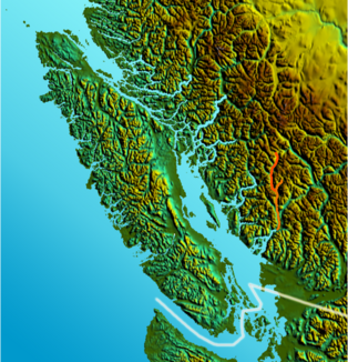
Location of the river |
||
The Elaho River is a 65 km long right tributary of the Squamish River in the southwest of the Canadian province of British Columbia .
The Elaho River is fed by the Elaho Glacier in the Elaho Range , a mountain range in the Pacific Ranges . It flows initially in a south-easterly direction, later in a southerly direction through the mountains. To the east rises the mountain range of the Pemberton Icefield . From the right, he takes up the tributaries of Clendinning Creek and Sims Creek . In the lower reaches, it turns south-southeast and finally meets the Squamish River. The Elaho River drains an area of about 1200 km². The mean discharge is 104 m³ / s. The highest discharges are usually measured during the melting of the glaciers in the months of June to August.
Web links
- Elaho River . In: BC Geographical Names (English)

