Emmaus, Pennsylvania
|
|
This article was on the basis of substantive defects quality assurance side of the project USA entered. Help bring the quality of this article to an acceptable level and take part in the discussion ! A closer description on the resolving issues is missing. |
| Emmaus | ||
|---|---|---|
|
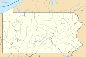
Location in Pennsylvania
|
||
| Basic data | ||
| Foundation : | 1759 | |
| State : | United States | |
| State : | Pennsylvania | |
| County : | Lehigh County | |
| Coordinates : | 40 ° 32 ′ N , 75 ° 30 ′ W | |
| Time zone : | Eastern ( UTC − 5 / −4 ) | |
| Residents : | 11,313 (as of: 2000) | |
| Population density : | 1,508.4 inhabitants per km 2 | |
| Area : | 7.5 km 2 (approx. 3 mi 2 ) of which 7.5 km 2 (approx. 3 mi 2 ) are land |
|
| Height : | 136 m | |
| Postal code : | 18049 | |
| Area code : | +1 610 | |
| FIPS : | 42-23584 | |
| GNIS ID : | 1174241 | |
| Website : | www.borough.emmaus.pa.us | |
| Mayor : | Winfield Iobst | |
Emmaus is a borough in Lehigh County in eastern US -amerikanischen state of Pennsylvania . It is six miles southwest of Allentown . In 2000 Emmaus had 11,313 inhabitants. The place was founded in 1759 as a settlement of the Moravian Brethren or Brethren Unity in North America. From 1830 to 1938 the place name was Emaus , which is due to the spelling of the Pennsylvania Dutch . Emmaus is directly connected to Interstate 78 by Cedar Crest Boulevard .

