Emswehr Rheine
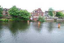
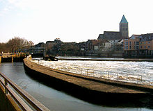
The Emswehr Rheine is a structure to regulate the water balance of the Ems in the area of the city of Rheine . It also serves to make the Ems navigable and to generate hydropower. It is one of the city's landmarks.
The attachment
The Emswehr in Rheine consists of the weir itself and a side channel along with two locks on the eastern bank. A free flood and a fish passage are connected to the weir . On the western bank of the river, in the old Emsmühle, there is a modern run-of-river power plant with a turbine channel that feeds the water behind the limestone cliffs back into the Ems. The saltworks canal begins at the old Emsmühle and leads to the former saltworks in Bentlage, where it drove a water wheel. The old Jewish cemetery was located above the salt canal .
The old Emsfurt
Before the first wooden weir was built, there was a ford a few meters behind the weir that was used to cross the Ems. This ford was probably the reason why Rheine developed at this point. Limestone cliffs from the Jura created a shallow spot in the Ems. Today, a few meters of the limestone rock can still be seen in front of the weir. The ford was located where the “Waskschapp”, the washing station of Rheine, was built later. This ford sank before 1362 in the floods of the Ems, which was dammed up by a first weir. Since then, a bridge has connected the two banks. Today, memorial plaques on the Waskschapp and the town hall remind of the ford.
The weir
The first wooden weir was built before 1362 when it was first mentioned in writing. From the beginning it served the damming of the Ems to make it usable by water mills and improved navigability, which was very hindered by the limestone cliffs in this area. It consisted of wooden fascines and caused high maintenance costs due to floods and ice in winter.
The bishop of Münster and Osnabrück Franz von Waldeck planned the construction of the stone Emswehr, as the high-performance mill often came to a standstill due to maintenance work. This weir was built in 1550 from sandstones from the Huckberg . It is 3 meters high and 3.35 meters wide. The Knights of the Cross from Bentlage also took part in this construction, they supplied stones and the brothers also helped with the construction themselves.
The first lock at the weir was built between 1579 and 1780. Before the lock was built, the goods had to be reloaded at the weir.
In 1841 construction of the ship canal began. The aim was to improve navigability in the area of the weir. The fish pass and the flood gate were also created. From the time of completion in 1843 until today, the face of the weir has hardly changed.
The ship canal
Construction of the ship canal began in 1841 and was completed in 1843. The ship's canal is around 900 meters long, starts at the Emswehr with the upper lock and ends behind the limestone cliffs with the lower lock. The mills on the right bank of the Ems had to be demolished for the ship canal. According to tradition, a copper mill, paper mill, sawmill, groats mill and pearl mill were located here. With the construction of the railway in 1856, the importance of shipping on the Ems declined. The canal was mainly used with the Emspünten , open embankments that were specially built for the Ems. With the construction of the Dortmund-Ems Canal in 1899, shipping on the Ems became dispensable and ceased with the start of the First World War in 1914. Today the ship canal is mainly used as a territory for recreational boaters.
Upper lock
The upper lock at the weir has a usable length of 26.70 m and a width of 5.80 m. At medium water levels, a height difference of 1.75 m to the canal is overcome. However, this height depends on the water level of the Ems. Filling and emptying contactors are in the Miter gates of the lock installed. The lock is operated manually.
Lower lock
The lower sluice has the same dimensions as the upper sluice, but the difference in height is slightly larger here at 2.54 meters at average water level.
Flood gate
The weir's flood gate is located between the weir and the ship canal. When the water level in the Ems rises, the gate can be raised and a larger amount of water can be drained.
Fish pass
The fish pass was created with the creation of the ship canal. It has been adapted and rebuilt several times to meet the needs of the fish. From today's point of view, however, the fish pass is not an optimal solution. Due to its small opening, the lure current can hardly be found by the fish, both in the upper water and in the lower water. Together with interest groups, the Münster district government is currently planning a second fish passage near the mill on behalf of the federal waterways and shipping administration .
Emsmühle
According to Franz Kolck, the first Emsmühle was built on this site at the time of Kals the Great. It is documented for the first time with the Emswehr in 1362.
In 1754, the Bishop of Münster, Clemens August I of Bavaria , had a new building built. This new building had three mill passages with three water wheels between the mill and the weir. For the time, the building was very functional and without any decorations. The single-storey structure was built from Huckberg sandstone . In the southern part of the building there were two water wheels in the building for an oil and fulling mill.
After a fire in 1894, the mill was raised by one floor made of lighter Ibbenbüren sandstone and the water wheels were replaced with turbines .
In 1937 a silo was added to the mill, which is decorated with the portrait of a sower by the painter Karl Wenzel. During the construction of the silo, the former city moat caused many problems that ran in this area.

After several fires in 1928, 1930 and 1937 and the destruction by bombs in 1943, the mill was rebuilt with two more storeys made of brick. Another turbine house was added to the side. The mill itself was shut down on December 31, 1964.
In 1985 the mill was used again to generate electricity. Since then, it has been producing 900,000 kWh of electricity annually with two turbines. With the commissioning of electricity production, the reconstruction of the mill as it was in 1897 began. The upper two floors of brick were removed and the old roof was put back on.
High water marks
Next to the mill door and on the flood wall towards the old town there are high water marks from the last centuries.
The highest water level ever measured in Rheine is from February 10, 1946. The floods of 1775, 1880 and 1926 are by far below this mark.
A flood protection wall erected in the 1970s is intended to prevent another flood from breaking into the urban area of Rheine. It is raised higher than the 1946 flood.
Saline Canal
To the left of the Ems, the saline canal branches off behind the mill to the Gottesgabe saline in Bentlage . The saline canal was laid out from 1743 to 1747 to operate the water wheels for brine pumping.
Web links
- Rheine Water and Shipping Authority lock system
- New fish passage
- Flood photos of the Ems near Rheine
literature
- Franz Kolck: “Rheine through the ages” . Rheine, 1965
Coordinates: 52 ° 16 ′ 52.5 ″ N , 7 ° 26 ′ 20 ″ E


