Entella (river)
| Entella | ||
|
Mouth of the entella |
||
| Data | ||
| location | Europe | |
| River system | Entella | |
| River basin district | Appennino Settentrionale | |
| source | Graveglia, Sturla and Lavagna rivers | |
| Source height | 3 m | |
| muzzle |
Golfo del Tigullio Coordinates: 44 ° 18 ′ 40 " N , 9 ° 19 ′ 58" E 44 ° 18 ′ 40 " N , 9 ° 19 ′ 58" E |
|
| Mouth height | 0 m | |
| Height difference | 3 m | |
| Bottom slope | 0.38 ‰ | |
| length | 8 kilometers | |
| Drain |
MQ |
15 m³ / s |
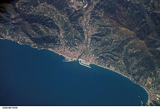
The Entella river has its source at the confluence of the three rivers Lavagna , Graveglia and Sturla at the level of the municipality of Carasco . The wide river bed is mostly covered with pebbles and ends after a short distance of eight kilometers in the Golfo del Tigullio of the Ligurian Sea . Despite its limited length, the Entella forms one of the largest plains (the Entella plain ) in the Liguria region . The mouth of the river is between the two towns of Chiavari and Lavagna .
With an average flow rate of 15 m³ / s, the Entella is the largest watercourse in the metropolitan city of Genoa . The groundwater network it feeds serves as a water supply for the two cities of Chiavari and Lavagna. The flow rate varies greatly with the seasons, so it can reach up to 2,800 m³ / s in autumn, which in the past has led to severe flooding of the zone.
