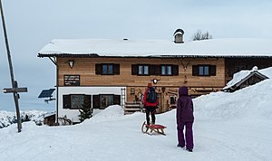
Enzianhütte (Zillertal Alps)
| Gentian hut | ||
|---|---|---|
|
Enzianhütte in winter from the south |
||
| location | on a ridge west of the Flastschspitze above Brennerbad ; South Tyrol , Italy ; Valley location: Brenner | |
| Mountain range | Zillertal Alps | |
| Geographical location: | 46 ° 58 '15 " N , 11 ° 29' 54.7" E | |
| Altitude | 1894 m slm | |
|
|
||
| Construction type | hut | |
| Development | Street | |
| accommodation | 22 beds, 21 camps | |
| Hut directory | PES | |
The Enzianhütte is a private refuge in the western Zillertal Alps at an altitude of 1894 m .
The hut is located about four kilometers south of the Brenner Pass in the former Zirog ski area above the hamlet of Brennerbad (municipality of Brenner ). The hut is managed in summer and winter. In winter, the access road is prepared as a toboggan run. The hut is the starting point for climbing the Wolfendorn ( 2774 m ), the Flatschspitze ( 2566 m ) or the Rollspitze ( 2800 m ). A transition to Kematen in the Pfitscher Valley is possible via the Schlüsseljoch ( 2212 m ) .
Neighboring shelters are the Landshuter Europahütte near the Kraxentrager directly on the border between Austria and Italy or the private Hühnerspielhütte above Gossensaß .
Web links
Individual evidence
- ↑ www.winterrodeln.org: Enzianhütte ; accessed on January 5, 2014.
- ↑ Enzianhütte on Almenrausch.at ; accessed on January 5, 2014.

