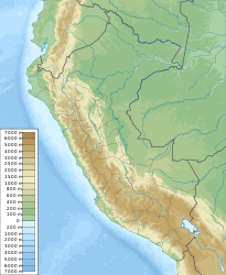
Earthquake in Peru on December 9, 1970
| Earthquake in Peru | ||
|---|---|---|
|
|
||
| date | December 10, 1970 UTC | |
| Time | 04:34:41 UTC | |
| intensity | IX on the MM scale | |
| Magnitude | 7.2 M W | |
| depth | 25 km | |
| epicenter | 4 ° 1 '34 " S , 80 ° 32' 31" W | |
| country | Peru , Ecuador | |
| dead | 82 | |
The earthquake in Peru on December 9, 1970 occurred at 11:34 p.m. local time in northern Peru on the border with Ecuador .
The quake had its epicenter south of the Gulf of Guayaquil and a focus depth of 25 kilometers. It shook the ground with a magnitude of 7.2 MW and was perceived with an intensity up to level IX on the Modified Mercalli Scale . In the Ecuadorian capital Quito , the quake could still be felt with an intensity of level III.
The quake was probably an intraplate earthquake of the South American plate , under which the Nazca plate subducts .
Several aftershocks occurred during December, at least ten of them with magnitudes of 5.0 or greater, with the strongest reaching a magnitude of 6.0.
The earthquake killed 50 people in Peru and 32 people in Ecuador. Several hundred were injured. Serious damage occurred in Ecuador mainly in the province of Loja , 90 percent of the city of Alamor was destroyed and Macará and Cariamanga were also badly affected. In Peru, the cities of Tumbes , Talara , Sullana , Querecotillo and Piura were badly hit.
supporting documents
- ↑ M 7.2 - Peru-Ecuador border region. USGS , accessed July 20, 2020.
- ↑ a b c Significant Earthquake: PERU: N; ECUADOR: S. NOAA , accessed on July 20, 2020.
- ↑ Thorne Lay, Luciana Astiz, Hiroo Kanamori, Douglas H. Christensen: Temporal variation of large intraplate earthquakes in coupled subduction zones. In: Physics of the Earth and Planetary Interiors. Volume 54, 1989, p. 268, digital version online ( memento from March 19, 2012 in the Internet Archive ) (PDF; 8.8 MB) on caltech.edu (English).

