
Erdmannsdorf (Lippersdorf-Erdmannsdorf)
|
Erdmannsdorf
Community Lipper-Erdmannsdorf
Coordinates: 50 ° 49 ′ 49 ″ N , 11 ° 46 ′ 46 ″ E
|
|
|---|---|
| Height : | 222 m above sea level NN |
| Residents : | 160 (2012) |
| Incorporation : | June 20, 1957 |
| Postal code : | 07646 |
| Area code : | 036426 |
 |
|
Erdmannsdorf is a district of the municipality of Lippersdorf-Erdmannsdorf in the Saale-Holzland district in Thuringia .
location
Erdmannsdorf is one kilometer west of the village of Lippersdorf and therefore has roughly the same environment. Stadtroda is a little closer. The Roda also flows in the valley. The slopes on both sides are steep and wooded, like the hills. Saale-Holzland is also here .
history
The village was first mentioned on March 31, 1206. 160 residents lived in the district in 2012.

Community hall in Erdmannsdorf
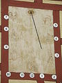
Sundial at the parish hall in Erdmannsdorf

Half-timbered house in Erdmannsdorf


Individual evidence
- ^ Wolfgang Kahl : First mention of Thuringian towns and villages. A manual. 5th, improved and considerably enlarged edition. Rockstuhl, Bad Langensalza 2010, ISBN 978-3-86777-202-0 , p. 70.
Web links
Commons : Erdmannsdorf - Collection of images, videos and audio files