Errol, New Hampshire
| Errol | ||
|---|---|---|
 Main Street, the main street in Errol, 2012 |
||
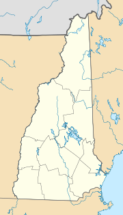
| Location in New Hampshire | ||
|
|
||
| Basic data | ||
| State : | United States | |
| State : | New Hampshire | |
| County : | Coös County | |
| Coordinates : | 44 ° 47 ′ N , 71 ° 8 ′ W | |
| Time zone : | Eastern ( UTC − 5 / −4 ) | |
| Residents : | 291 (as of 2010) | |
| Population density : | 1.8 inhabitants per km 2 | |
| Area : | 180.7 km 2 (approx. 70 mi 2 ) of which 157.4 km 2 (approx. 61 mi 2 ) are land |
|
| Height : | 456 m | |
| Postal code : | 03579 | |
| Area code : | +1 603 | |
| FIPS : | 33-25140 | |
| GNIS ID : | 0873593 | |
Errol is a place in the US state of New Hampshire . It is north of the White Mountains in Coös County . According to the 2010 population census, it had 291 inhabitants.
history
The area of Errol was given to Timothy Ruggles and other interested parties by the British Governor John Wentworth in 1774. The name is derived from James Hay, 15th Earl of Erroll , a Scottish nobleman. Ruggles was one of the British loyalists who had to leave the country after the founding of the US and the defeat of Britain.
In 1779 the owners asked the Supreme Court of the state, which was now part of the United States, to build a connection road to Conway . In 1781 the construction of today's Route 16 was commissioned. In 1804 a winter road to Andover was built , connecting Errol to Portland on the Atlantic coast. (now Route 26). This also provided a road connection to Umbagog Lake .
It was not until 1806 that the first settlers reached the village, which in 1820 already had 36 inhabitants. The main employer was the local timber industry, because the soil was at best suitable for potatoes and oats. In 1835 the Mormon baptized Benjamin Sweat several times in the town. 1859 there were 130 residents who operated a sawmill and a flour mill, to a company that the boards for facades in the widespread weatherboarding produced (clapboard).
In 2001 the municipality bought 2500 hectares of forest.
Web links
Remarks
- ↑ American FactFinder , 2010 Census figures.
- ↑ Androscoggin Timeline
- ^ Jan Shipps, John W. Welch (Eds.): The Journals of William E. McLellin, 1831-1836 , University of Illinois Press, 1994, p. 317.
- ↑ Austin JK. Coolidge, John B. Mansfield: A History and Description of New England , Boston 1859, p. 487.

