Colebrook, New Hampshire
| Colebrook | ||
|---|---|---|
 Colebrook Main Street in 2009 |
||
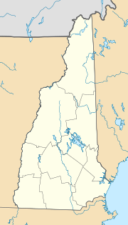
| Location in New Hampshire | ||
|
|
||
| Basic data | ||
| Foundation : | 1796 | |
| State : | United States | |
| State : | New Hampshire | |
| County : | Coös County | |
| Coordinates : | 44 ° 54 ′ N , 71 ° 30 ′ W | |
| Time zone : | Eastern ( UTC − 5 / −4 ) | |
| Residents : | 2,139 (as of 2017) | |
| Population density : | 20.2 inhabitants per km 2 | |
| Area : | 106.2 km 2 (approx. 41 mi 2 ) of which 105.7 km 2 (approx. 41 mi 2 ) is land |
|
| Height : | 436 m | |
| Postal code : | 03576 | |
| Area code : | +1 603 | |
| FIPS : | 33-13780 | |
| GNIS ID : | 871097 | |
| Website : | www.colebrooknh.org | |
The Town of Colebrook is an administrative district in Coös County in northern New Hampshire , one of the United States' New England states . The first settlement permit dates to 1762. In 2017, 2139 inhabitants were counted. In addition to the main town of the same name, Colebrook also includes Kidderville, Upper Kidderville, and Factory Village.
geography
Colebrook is on the Connecticut River . Colebrook borders Stewartstown to the north, Dixville to the east , and Columbia to the south . On the other side of Connecticut are Canaan and Lemington , Vermont . To the east rise the Dixville Mountains, part of the White Mountains from which the Mohawk River flows into Connecticut. The Beaver Brook Falls are in the Colebrook area.
history
The first granting of settlement rights of today's Colebrook took place in 1762 under the name Dryden . The name was chosen by the then governor of New Hampshire, Benning Wentworth . The buyers of the rights, settlers from New York, including the Dutch, were supposed to promote the colonization of the areas west of the Connecticut River . This later became the colony and then the state of Vermont . Since Dryden remained uninhabited, Benning Wentworth's nephew, John Wentworth , who had succeeded his uncle as governor , sold the settlement rights to Sir George Colebrooke, then chairman of the British East India Company , and Sir James Cockburn, John on December 1, 1770 Stewarts from England, as well as John Nelson, who came from Grenada . In the course of this, the name was changed to Colebrook, but he never even looked at his properties. The area remained uninhabited until after the American Revolution. It was officially registered under this name on June 11, 1796. Six years earlier, the first survey counted 29 residents. The first school was built in 1795 and the first church did not follow until 1802. At that time agriculture and logging were the main sources of income for the residents. The first sawmill was built in 1800, and over the course of the century there were a total of 16. Bricks were also burned and a wool factory was built in 1812 at what is now known as the Factory Village. The production of potato starch began in 1840. Thirty years later, in 1870, 12 mills produced 5% of the total consumption of potato starch in the entire United States, and Colebrook was the wealthiest town in New Hampshire. A local dairy industry emerged in the late 19th century, delivering raw milk to Boston thanks to the construction of the railroad in 1889 and ice that was sawn from the surrounding lakes in winter.
Administration and public institutions
The administration of the city is the responsibility of three elected city councils (selectmen) and a moderator. The police station is manned all day, the fire brigade consists of volunteers under a municipal director. Emergency medical care is private, but there is one municipal hospital, Upper Connecticut Valley Hospital. The city also operates a public library. There is both a primary and a university. The closest college is the Granite State College in Berlin .
economy
Nowadays Colebrook lives mainly from tourism. It is in the Great North Woods tourist region, which encompasses northern New Hampshire north of the White Mountains. The town offers opportunities for hunting and fishing, a golf course, and winter ski and snowmobile trails. In addition, the cultivation of Christmas trees and the extraction and processing of maple syrup play a role. The largest employers are the hospital, a clothing wholesaler and manufacturer, the Town of Colebrook, the school district and Granite Bank, which has existed since 1889.
traffic
Colebrook is on US 3 . In the urban area this crosses the state road NH 26, also New England Interstate Route 26, to Portland . North of it branches off from US 3 the NH 145, which leads parallel to the former to Pittsburg . The closest interstate, I-91 , is 49 miles away in Vermont. Closer is Autoroute 55 in Quebec. Colebrook is 205 miles from Boston, but only 130 miles from Montreal . Colebrook has local public transport as well as its own airfield, Gifford Field. The nearest scheduled airport is Portland International Jetport in Maine .
Sons and daughters of the place
- Chester B. Jordan (1839-1914), politician
- Irving W. Drew (1845-1922), politician
- Allen Augustus Tirrill (1872–1925), electrical engineer and inventor
- Clarence A. Forbes (1901-2001), historian
