Estéron
| Estéron | ||
|
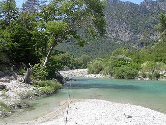
In the upper reaches the river has turquoise water |
||
| Data | ||
| Water code | FR : Y64-0400 | |
| location | France , Provence-Alpes-Cote d'Azur region | |
| River system | Var | |
| Drain over | Var → Mediterranean | |
| source | at Soleilhas 43 ° 51 ′ 28 ″ N , 6 ° 36 ′ 24 ″ E |
|
| Source height | approx. 1550 m | |
| muzzle | at Saint-Martin-du-Var in the Var coordinates: 43 ° 49 ′ 6 " N , 7 ° 11 ′ 6" E 43 ° 49 ′ 6 " N , 7 ° 11 ′ 6" E |
|
| Mouth height | approx. 100 m | |
| Height difference | approx. 1450 m | |
| Bottom slope | approx. 22 ‰ | |
| length | 67 km | |
|
The village of Gilette , behind it the estuary of the Estéron. |
||
The Estéron is a river in France that runs in the Provence-Alpes-Côte d'Azur region . It rises in the southern foothills of the Maritime Alps, northwest of Nice , on the northern flank of the Crête du Teillon , in the municipality of Soleilhas , generally drains in an easterly direction and, after 67 kilometers, flows into the Var as a right tributary at Saint-Martin-du- Var . On its way, the Estéron crosses the Alpes-de-Haute-Provence and Alpes-Maritimes departments .
Places on the river
Attractions
The gorges of the Estéron are among the most beautiful landscapes in the pre-Alps of the Maritime Alps (Provencal pre-Alps), such as B.
- Clue de Saint-Auban
- Clue d'Aiglun
- Gorges de l'Estéron
See also
- List of French Mediterranean tributaries and their tributaries, from 36 km in length, sorted geographically
Web links
Commons : Estéron - collection of images, videos and audio files

