Fairfield (Lake District)
| Fairfield | ||
|---|---|---|
|
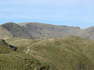
Looking for Fairfield from Heron Pike |
||
| height | 873 m ASL | |
| location | Cumbria , England | |
| Mountains | Cumbrian Mountains | |
| Coordinates | 54 ° 29 '49 " N , 2 ° 59' 26" W | |
|
|
||
| Type | Wainwright , Marilyn | |
Fairfield is a mountain in the Lake District , Cumbria , England . The mountain is 873 m high and has a notch height of 299 m, which identifies it as Marilyn .
The northern and southern flanks of the mountain are very different in character. The southern flank, at the foot of which is the Grisedale Tarn , is gently rising, characterized by grassy meadows and is reminiscent of a horseshoe. The north flank, on the other hand, rises much more dramatically steep and interspersed with rocky outcrops, something that Alfred Wainwright described in his description of the mountain as much more popular - because more dramatic - with visitors to the Lake District.
There are a variety of ways to climb Fairfield. It is possible to climb the mountain from Grasmere as well as from Patterdale . A path also leads up the mountain from the Dunmail Raise Pass. The Fairfield can also be climbed as the highlight of the Fairfield Horseshoe Trail.
swell
- Alfred Wainwright , A Pictorial Guide to the Lakeland Fells, Book 2 The Far Eastern Fells. ISBN 0-7112-2455-2

