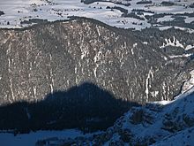
Falkenstein ridge

The Falkensteinkamm or Zirmgrat is a mountain range on the northeastern edge of the Allgäu Alps between Pfronten and Füssen . The highest peak is the Salober or Zwölferkopf ( 1293 m ). The border between Bavaria and Tyrol runs along a large part of the ridge.
The Falkensteinkamm is the smallest subgroup of the Allgäu Alps, consisting of a single mountain range about seven kilometers long. Its independence results from the fact that it is clearly separated from the Tannheimer mountains south by the valley of the Vils . The ridge runs towards east-southeast-west-northwest between Pfronten-Steinach in the west and the deeply incised Lech with the Lechfall near Füssen in the east. To the east of the Lech are the Ammergau Alps .
The most important peaks, mostly not very pronounced, are from west to east the Falkenstein (1267 m) with the Falkenstein Castle , Einerkopf (1252 m), Zwölferkopf (1283 m), Salober (1293 m) and Vilser Berg (1023 m, too Unterberg ). In the area between Einerkopf and Salober, some maps and guides have different names and / or heights. To the north of the ridge, the mountain range includes the famous and legendary Alatsee ; on the northern edge is the larger Weissensee . At Füssen there is a series of three small lakes called Ober- , Mitter- and Untersee .
The entire mountain group is forested throughout; the view from the ridge is very limited. Due to the prevailing Wetterstein limestone , however, there are some striking rock art. The south side is partly a steep demolition. The ridge can only be crossed on paths at Falkenstein, at Salober-Alm , through Vilser Scharte and through Ländenscharte on Vilser Berg. A hike near the ridge is only possible in the western half, between Steinach and the Salober Alm. This ridge hike is part of the Maximiliansweg (stage 6) and thus the European long-distance hiking trail E4 ; to the east, the path runs along the north side of the Falkensteinkamm by the Alatsee and the three Füssen lakes.
In the vicinity of the Ländenscharte, the Falkensteinkamm is crossed by a high-voltage road and crossed by the Füssen border tunnel .
Notes and evidence
- ↑ Accordingly, the Alpine Club Guide Allgäu and Ammergau Alps with Tannheimer Mountains (Dieter Seibert, 17th edition, Munich: Bergverlag Rother 2008) deals with the "Falkenstein ridge" on less than one page: "Excursions only take place in the western part of the ridge still alpine character, therefore only they are mentioned in the following. " This is followed by entries to the Falkenstein (1267m) and the Zirmgrat (1293m).
- ↑ According to the AV guide already quoted, who specifies the "Zirngrat" (1293m) as the highest peak and Einerkopf (1260m) and Zwölferkopf (1287m) as the neighboring peaks. Deviations between the German and Austrian topographic maps are described in the Salober article.
Coordinates: 47 ° 34 ' N , 10 ° 37' E