Fallersee
| Fallersee | ||
|---|---|---|

|
||
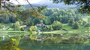
| View over the Fallersee to Bad Schnifis | ||
| Geographical location | Vorarlberg , Austria | |
| Tributaries | Fallersbach | |
| Drain | [Fallersbach? →] Sägabach → Riedgraben → Vermülsbach → Giesenbach → Ill → Rhine → North Sea | |
| Places on the shore | Schnifis | |
| Data | ||
| Coordinates | 47 ° 12 '51.8 " N , 9 ° 44' 11.8" E | |
|
|
||
| Altitude above sea level | 683 m above sea level A. | |
| surface | 1 hectare | |
| length | 189 m | |
| width | 85 m | |
| Maximum depth | 3 m | |
The Fallersee (also "Schnifner Weiher", 683 m above sea level ) is an artificially dammed lake in Schnifis in ( Vorarlberg , Austria ). The former Bad Schnifis spa is located on the bank of the lake in the "Bädle" plot.
history
The Fallersee is a stagnant body of water and was created in 1968 by the Fallersee fishing association (FV-Fallersee) from Schnifis and flooded on July 5, 1968. It is artificially stocked with fish and managed. At the point of the lake there was previously another pond and then a so-called “clay hole”. Clay was extracted from this and processed into roof tiles.
Surname
Faller is said to go back to Latin : vallis for valley . The term lake has been chosen to be misleading for this body of water, because of its size (depth) and extent it is more like a pond .
Geography / topography
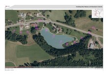
The Fallersee is about 20 m south of the Schnifis baths near Jagdbergstraße (L 54). The Fallersbach flows through the lake. It is about 1 hectare in size and a maximum of 3 meters deep. The bottom of the water is dominated by sand and gravel. The lake is considered to be poor in nutrients.
The lake is about 600 m from the center of the village and at the eastern end of the populated area of Schnifis, about 1200 m from the municipality boundary of Thuringia , 1100 m from the municipality boundary with Thuringianberg , about 1000 m from the municipality boundary of Bludesch and 800 m from the Municipality boundary away from Dünserberg . It is about 11 km as the crow flies to the city center of Feldkirch and about 35 km to Lake Constance . At the back of the Fallersee, near the catchment area of the stream, there is a Kneipp basin belonging to the community. This is freely accessible and was rebuilt in 2014 by apprentices from Hilti in Thuringia .
use
The Fallersee is used as part of sport fishing and is also a publicly approved natural swimming area (in a partial area).
At the north-western end of the lake there are so-called "whisper mirrors". This is a possibility to experimentally test the function of the reflection of sound waves, in that information can be exchanged via the parabolic mirrors (90 m away) through acoustic noise transmission (acoustic reflection) without additional energy supply. The two parabolic mirrors serve as both a transmitter and a receiver. The higher the frequency of the noise (e.g. speech), the better the reception.
At the southeast end of the lake is a small fish farm that drains into the lake.
Web links
Individual evidence
- ↑ Doris Gesierich, Diatomaceous algae in selected aquatic habitats in the Jagdberg communities (Vorarlberg, Austria) - Species diversity and endangerment , p. 257.
- ^ Association founded on May 18, 1968. ZVR : 499617929.
- ↑ Parish Schnifis - Fallersee .
- ↑ a b Documentation of field names in triad: Schnifis, Düns, Dünserberg (A) , last accessed on June 15, 2017.
- ↑ Doris Gesierich, Diatomaceous algae in selected aquatic habitats in the Jagdberg communities (Vorarlberg, Austria) - Species diversity and endangerment , p. 257.
- ^ State of Vorarlberg - Fallersee , Limnological study of July 10, 2002.
- ^ Pools in Walgau , p. 2.


