Faning
|
Faning ( village ) locality |
||
|---|---|---|
|
|
||
| Basic data | ||
| Pole. District , state | Klagenfurt-Land (KL), Carinthia | |
| Judicial district | Klagenfurt | |
| Pole. local community | Moosburg ( KG Tigring) | |
| Coordinates | 46 ° 41 '20 " N , 14 ° 13' 4" E | |
| Residents of the village | 53 (January 1, 2020) | |
| Building status | 17 (2001) | |
| Statistical identification | ||
| Locality code | 01206 | |
| Counting district / district | Gabriel (20421 003) | |

|
||
| Source: STAT : index of places ; BEV : GEONAM ; KAGIS | ||
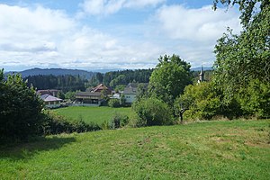
Faning is a district of Moosburg in the cadastral municipality of Tigring. The village is located at the southeastern foot of the 805 m high Freudenberg with a view to the south over the Klagenfurt Basin to the Karawanken .
history
Around 1070 a Vaniccha estate was mentioned in a document as an exchange object for the Freising people . The Church of St. Agnes is a Romanesque building and was a subsidiary of Maria Wörth until 1784.
Neighboring places
| Nussberg | ||
| Windischbach |

|
Capital case |
| Tigring | Seigbichl | Ponfeld |
economy
The main line of business in Faning is agriculture (vegetable and fruit growing, livestock and small animal husbandry, meadow management, arable farming) and the marketing of agricultural products.
Web links
Commons : Faning - collection of pictures, videos and audio files

