Feistritz reservoir
| Feistritz reservoir | ||
|---|---|---|

|
||
| Wind turbine on a peninsula in the Feistritz reservoir | ||
| Geographical location | Feistritz in the Rosental | |
| Tributaries | Outside | |
| Drain | Outside | |
| Data | ||
| Coordinates | 46 ° 31 '57 " N , 14 ° 9' 10" E | |
|
|
||
| Altitude above sea level | 462 m above sea level A. | |
The Feistritz reservoir is the backwater of the Drau by the Feistritz-Ludmannsdorf power plant in the Austrian state of Carinthia . The reservoir extends from Feistritz im Rosental to Sankt Jakob im Rosental .
The Feistritz-Ludmannsdorf power plant was built between 1965 and 1968 as part of the power plant chain along the Drau. The Austrian part includes ten reservoirs between Spittal an der Drau and the border with Slovenia . The Ferlach reservoir follows downstream .
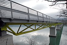
The upper limit of the reservoir is formed by the western edge of the Selkach Bridge, the lower limit is the dam of the power plant. The reservoir is 8 kilometers long and forms some bays and docks. Some sections of the north bank can only be reached by boat. The fish stocks include most of the fish species native to Carinthia's river systems.
Individual evidence
- ↑ Feistritz-Ludmannsdorf run-of-river power station. Verbund AG , accessed on September 10, 2019 .
- ↑ Feistritzer Stausee at Anglerinfo.at, accessed on September 10, 2019

