
Feldnerhütte
| Feldnerhütte ÖAV hut category I |
||
|---|---|---|
 Feldnerhütte, behind the Kreuzeck ( 2702 m ) |
||
| location | Greifenburg ; Carinthia , Austria | |
| Mountain range | Kreuzeckgruppe | |
| Geographical location: | 46 ° 49 '55.7 " N , 13 ° 7' 30.5" E | |
| Altitude | 2182 m above sea level A. | |
|
||
| owner | ÖAV section clove | |
| Built | 1885 | |
| Construction type | hut | |
| Usual opening times | Mid June - mid September | |
| accommodation | 9 beds, 30 camps | |
| Winter room | 6 bearings | |
| Web link | Site of the hut | |
| Hut directory | ÖAV DAV | |

The Feldnerhütte is a refuge of the Steinnelke section of the Austrian Alpine Club (ÖAV) in the Kreuzeck group .
location
The hut is located at an altitude of 2182 m above sea level. A. am Glanzsee in the municipality of Greifenburg . The Kreuzeck-Höhenweg and the Salzburg – Trieste Alpine crossing lead past the hut.
history
The Feldnerhütte was built in 1884 and 1885 by the Villach Section and later taken over by the Steinnelke Section. After a fire, it was rebuilt from 1988 to 1989.
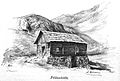
Feldnerhütte 1894

ways
Approaches
- from Gnoppnitz ( 1091 m ), walking time 5 hours
- from Greifenburg ( 600 m ), walking time 6 hours
- from the fisherman's hut ( 1500 m ), walking time 2½ hours
- from Napplach-Teuchl-Alpenheim ( 1200 m ) ⊙ , walking time 6 hours
- from the Gaugenschutzhaus ( 1616 m ) ⊙ , walking time 4½ hours
Mountaineering
- Kreuzeck ( 2702 m ), walking time 1¾ hours
- Hochkreuz ( 2708 m ), walking time 3 hours
- Tristen ( 2535 m ), walking time 3 hours
- Dechant ( 2609 m ), walking time 1¼ hours
- Emberger Alm , walking time 4¼ hours
Transitions
- Hugo-Gerbers-Hut ( 2347 m ), walking time 6 hours
- Polinikhütte ( 1884 m ), walking time 11 hours
- Salzkofelhütte ( 1987 m ), walking time 6 hours
source
- Feldnerhuette's website. Retrieved November 10, 2017 .
Web links
Commons : Feldnerhütte - Collection of images, videos and audio files
- Karl Georg Kreiter: Feldner Hut. Retrieved November 10, 2017 .