Rock inscriptions from Gürün
Coordinates: 38 ° 45 ′ 27.7 ″ N , 37 ° 13 ′ 50.5 ″ E
The rock inscriptions from Gürün in central Turkey are two versions of an inscription in Luwian hieroglyphics . They date from the time between the fall of the Hittite empire and the 9th century BC. BC, probably from the late 12th or 11th century.
location
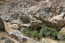
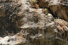
The inscriptions are located about five kilometers northwest of Gürün in the district of the same name in the Turkish province of Sivas . At this point, the Tohma Çayı River emerges from the Suğul Kanyonu Gorge into a wide valley. From Gürün a drivable road signposted Suğul Vadisi leads to the canyon, which is accessible via artificially created footbridges. Above the opposite bank stands on a steep slope about six feet high boulder to the top of the two inscriptions Gürün B called. The writing field, which is about 1.70 meters wide and 1.20 meters high, is divided into two fields of different sizes by a crack in the rock. The right part consists of six lines separated by horizontal bars, the left part of two lines, which continue the two lower lines on the right side. A larger area has been smoothed over the left part and was apparently intended for additional writing or a picture, but was not used. The second inscription Gürün A is attached to a vault in the rock face about 30 meters to the northeast . It measures 1.50 meters in width and 0.90 meters in height and is in poor condition, as it was overflowed by spring water from the crevice above it for a long time. The text is written here in four lines, about a third is lost on the right side. Both inscriptions are identical in content and worked in relief.
The place belonged to the late Hittite kingdom of Melid when the monument was built . This bordered in the west on Tabal and in the south on Gurgum , in the north it extended far into the mountains to the headwaters of the Tohma Çayı and another Euphrates tributary , the east lying Kuru Çayı. The two rivers were the one responsible for the fertility of the plain of Malatya, on the other hand they made important arterial roads heading north to Hittite heartland is. Probably for this reason can be found on the two rivers except the inscriptions of Gürün more rock documents that disappeared today inscription from Kötükale downstream in the valley of Tohma Çayı and that of Şırzı above Kuru Çayı.
Inscriptions
The description and translation of the text follow the more legible inscription B. The author is Runtija, King of Malida (Melid). His name is represented by the logogram CERVUS, a deer's head with antlers, and is therefore identical to the name of the deer god , who is known from the inscription of Şırzı, the rock relief on Karasu and the stele of Hacıbebekli .
The text begins in the upper right corner and can be read boustrophedon . It is divided into four sections: Dedication to the gods, presentation with ancestry, narrative part and the usual curse formula. The dedication is aimed at the great Tarhunza , the great Hibadu and the great Sarruma , i.e. the three highest gods of the Hittite pantheon , as they are depicted, for example, in the rock temple of Yazılıkaya at the top of the god processions. This shows a close connection between the empire and the Hittite empire . Then Runtija introduces himself as the grandson of Kuzzitissuba, the great king, the hero of Karkamissa, son of PUGNUS-milis (1st), the sovereign of Malida . The grandfather Kuzzitissuba is among other things from seal impressions from the end times of the Hittite Empire around 1200–1185 BC. Known as king of the Hittite state of Karkemiš . After the end of the empire, Karkemiš became independent and Kuzzitissuba was the first ruler to call himself the great king in the Hittite tradition. From there, the Malida Empire was founded as a secondary school under Kuzzitissuba's son PUGNUS-milis, Runtija's father. In the following, different mountains are mentioned and the settlement of places is described:
In Taida… te (the mountains / mountains) Zinap / ba, Naḫ (a) ra / isa (and) Nama… […]
and I settled […] as / the city.
The locations cannot be localized due to lack of information, but are assumed to be in the immediate vicinity. Although no settlements of this time are known in the Tohma Çayı valley, the previously unexplored settlement hills Hüyüklü, Davulhöyük, Yılanhöyük and Taşlıhöyük can be found in the plain north of the ridge. The archaeologist Hans Henning von der Osten describes the ceramics there as very archaic . In the following formula of the curse, the three great gods Tarhunza, Hibadu and Sarruma are again named, who are supposed to sue whoever destroys the inscription.
Due to the known reigns of the named rulers, the inscription is dated to the late 12th century BC. Dated.
Research history
The British officer and geographer Charles William Wilson discovered the inscriptions in 1879. He visited the place in 1882, together with the Scottish archaeologist William Mitchell Ramsay, who in 1890 returned to the British David George Hogarth and squeezes anfertigte well as photographs and drawings. In 1907 the Cornell Expedition to Asia Minor visited the place. Further publications were made by the English ancient orientalist Archibald Henry Sayce (1908), the Polish-American ancient orientalist Ignace Gelb (1939), the Italian classical philologist Piero Meriggi (1962) and the British Hittite scientist John David Hawkins (2000), the included the copy in his corpus of Luwian inscriptions. Finally, in 2014 the German architect Horst Ehringhaus published a detailed description with photos in his book on Luwian rock reliefs.
Web links
literature
- Eberhard P. Rossner: Rock monuments in Turkey. Volume 1: The Hittite rock reliefs in Turkey. An archaeological guide. 2nd, expanded edition. Rossner, Munich 1988, ISBN 3-924390-02-9 , pp. 191-193.
- John David Hawkins: Corpus of hieroglyphic Luwian inscriptions . Vol 1. Inscriptions of the Iron Age . Part 1: Introduction, Karatepe, Karkamiš, Tell Ahmar, Maraş, Malatya, Commagene. de Gruyter, Berlin 2000, ISBN 3-11-010864-X , pp. 295-299, plates 135-138.
- Horst Ehringhaus: The end that was a beginning. Rock reliefs and rock inscriptions of the Luwian states of Asia Minor from 12. to 8./7. Century BC Chr. Nünnerich-Asmus, Mainz 2014, ISBN 978-3-943904-67-3 , pp. 83-87.
Individual evidence
- ↑ a b c d German translations quoted from Horst Ehringhaus: The end that was a beginning. Rock reliefs and rock inscriptions of the Luwian states of Asia Minor from 12. to 8./7. Century BC Chr. Nünnerich-Asmus, Mainz 2014, ISBN 978-3-943904-67-3 , pp. 35-38
- ^ Benson Brush Charles: Hittite Inscriptions ( Cornell Expedition to Asia Minor ). Ithaca / New York 1911, pp. 29-31 Fig. 30, 31 Pl. XVI.


