
Klein-Durren fortress

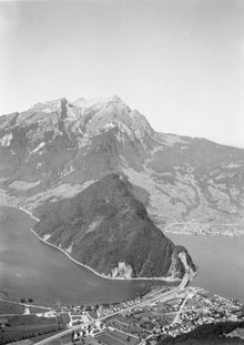
The Klein-Durren fortress (also known as Kleiner Durren ) is a former artillery work on the eastern flank of the Pilatus massif in the canton of Obwalden in Switzerland . The fortress is located at an altitude of 1205 m above sea level. M. in the rocks of the «Chli Turren» below the Ämsigen station of the Pilatusbahn .
Artillery Works Kleiner Durren
The fortress had been ready to fire since 1942. It consists of a two-story rock cavern and two by four casemates for the guns. The fire sector ranged from Bürgenstock to Buochs . The fortress was accessed by the Pilatusbahn from Alpnachstad . The fortress entrance was in the Upper Spycher Tunnel below the Ämsigen station. Towards the end of the 1950s, between Atzigen (Alpnachstad) and the fortress at 1122 m above sea level. M. built the Z207 military aerial cableway with a length of 1210 meters. Before that, the plant could only be reached on foot during the winter break.
The following guns, which should primarily affect the Buochs Reduit Airfield , were installed:
- In the years 1942–1951: lower and upper floors, four 12 cm cannons 1882 L25 each
- In the years 1951–1998: lower floor: four 10.5 cm fortress guns 1935 L42
The plant was taken over by the fortress artillery company 84 in 1944, operated by the fortress company II / 10 from 1962 and by the fortress artillery department 16 since the Army 95 . The last refresher course took place in June 1996.
The fortress was decommissioned in 1998, declassified in 2002 and cleared in 2008. The military cable car that had connected Atzigen to the fortress for 50 years had been dismantled earlier.
- Artillery Works Kleiner Durren A 2287: Entrance in the Spycher Tunnel ⊙
- Artillery works Kleiner Durren A 2287: four notches ⊙
- Bunker external defense Upper Spycher Tunnel ⊙
- Military cable car Z207 Atzigen / Rengg - Klein Durren mountain station ⊙ ⊙
Lock point Renggpass
The Renggpass on Pilate streamer Lopper is a transition between Hergiswil and Alpnachstad. The pass height is 886 m above sea level. M. The old Roman road was (inaugurated in 1861) before the construction of the road along the Lopper the only and much-used land route from Lucerne and Nidwalden to Obwalden and the Brünig Pass .
The Renggpass was of strategic importance and was fortified in the Middle Ages with a 250 meter long Letzi and parapet wall. The French invasion troops moved over the pass under General Schauenburg in 1798 to break the Nidwalden resistance . In stecklikrieg a battle of the insurgent Nidwaldner against the government troops took place there in August 1802 Helvetic central government instead.
In order to prevent Lopperstrasse from bypassing the footpath of the Renggpass, the Renggpass blocking point was set up during the Second World War .
- Small shelter A 2279 ⊙
- Shelter A 2281 ⊙
- Shelter A 2282 ⊙
- Shelter A 2283 ⊙
- Shelter A 2284 ⊙
- Shelter A 2285 ⊙
- Artillery observer A 2407 ⊙
- Artillery observer A 2408
- Infantry bunker Müli A 2425 Hergiswil ⊙
- Single-cable aerial tramway Z205 Atzigen - Renggpass (mountain station B1061): foundation ⊙
- Command post Infantry Regiment Inf Rgt 22, Krummhorn ⊙
- Command post Field Artillery Regiment F Art Rgt 4, Krummhorn ⊙
literature
- Bruno Bommeli: Pilatus Fortress: from Kleiner Durren over Loppergrat to Rotzloch . Documentation by the Swiss Society for Military History Study Trips GMS, 2004.
Web links
- Underground Switzerland: Artillery Works Kleine Durren A 2287 ( Memento from July 1, 2017 in the Internet Archive )
- Fortress Oberland 2018: Video artillery works Kleiner Durren A 2287
- Fortress Oberland 2019: Video military rock caverns for observers at Renggpass, Loppergrat
Individual evidence
- ↑ Video Pilatusbahn 2017: The former factory entrance follows on the video after 2:06 minutes
- ↑ Luzerner Zeitung of August 29, 2008: Pilatus Fortress will be the last to be cleared
- ↑ Neue Nidwaldner Zeitung Online from April 5, 2015: The Lucerne soldiers' rock cat is being refreshed .
- ↑ Jürg Stüssi-Lauterburg : Stecklikrieg. In: Historical Lexicon of Switzerland .
- ↑ Fortress Oberland: Renggpass barrier
Coordinates: 46 ° 58 ′ 7.7 " N , 8 ° 16 ′ 36" E ; CH1903: 663 773 / 202310