Firth of Tay
Coordinates: 56 ° 26 '2 " N , 3 ° 1' 32" W.
The Firth of Tay ( Scottish Gaelic An Linne Tatha ) is an estuary on the Scottish east coast. The eponymous Tay , the longest river in Scotland, flows into the head . During the 18th century, the banks were planted with thatch for fortification . Today it is the largest contiguous thatched area in the UK, accounting for around 15% of the total UK population.
geography
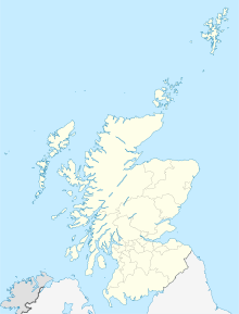
The narrow inlet extends northeast from the confluence of the Tays and Earn Rivers near Perth . After about 37 kilometers it opens to the North Sea . The maximum width of the Firth of Tay with its partly wide sandbars is five kilometers. The council areas of Perth and Kinross , Dundee , Fife and Angus stretch along the banks . The largest settlements include the city of Dundee and the communities of Monifieth and Invergowrie on the north bank. Located on the south bank are Newport-on-Tay and Tayport . In the Firth of Tay, at the height of Newburgh, lies the narrow Mugdrum Island .
bridges
With the Tay Road Bridge between Newport-on-Tay and Dundee and the Firth-of-Tay Bridge between Wormit and Dundee, a car and a railway bridge each span the arm of the sea. The latter was completed in 1878. After it collapsed in the course of the railway accident on the Firth of Tay Bridge in 1879, it was rebuilt three years later.
gallery
Individual evidence
- ↑ a b Entry in the Gazetteer of Scotland
- ^ Entry in the Gazetteer of Scotland
- ↑ Entry on Tay Bridge in Canmore, the database of Historic Environment Scotland (English)


