Flaxman Island
| Flaxman Island (Sidrak) | ||
|---|---|---|
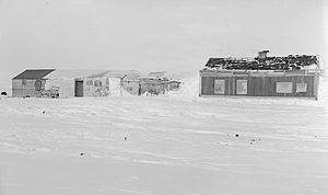
| Leffingwell's Hut on Flaxman Island, 1910 | ||
| Waters | Beaufortsee | |
| Geographical location | 70 ° 12 ′ N , 146 ° 2 ′ W | |
|
|
||
| length | 11 km | |
| width | 1 km | |
| Highest elevation | 8 m | |
| Residents | uninhabited | |
| Leffingwell's Hut on Flaxman Island, 1949 | ||
Flaxman Island or Sidrak ( Inupiaq "foxhole") is an island in the Beaufort Sea belonging to the North Slope Borough , Alaska .
geography
The elongated island is located immediately west of the Canning River Delta about three to four kilometers off the mainland of Alaska, from which it is separated by Lion Bay. It has typical tundra vegetation with numerous ponds . Erratic boulders point to an Ice Age past.
history
In August 1826 the British polar explorer John Franklin reached the island with 15 companions in two open boats. He named it after the sculptor John Flaxman .
In 1907 the Anglo-American Polar Expedition, which was jointly led by the Dane Ejnar Mikkelsen and the American Ernest de Koven Leffingwell (1875–1971), built a makeshift hut on the island from the remains of their ship, the Duchess of Bedford , which was dated from Ice had been crushed. Leffingwell used the property with some extensions until 1914 for his geological work in the region. It is now listed as number 32 on the list of National Historic Landmarks in Alaska .
On March 15, 1918, the first experiment with an ice drift station began on Flaxman Island . On Vilhjálmur Stefánsson's Canadian Arctic Expedition, Størker Størkersen marched with four men and 17 sled dogs from the island 450 km north and set up camp on the ice there. It was believed that the ice drift would reach the coast of Siberia within a year , but the floe only circled in a vortex. After half a year Storkerson broke off the venture due to illness and returned to Flaxman Island on November 8th.
literature
- Ernest de Koven Leffingwell: The Canning River Region, Northern Alaska (= United States Geological Survey Professional Paper . Volume 109 ). Washington 1919 ( digitized [PDF]).
Individual evidence
- ↑ Donald J. Orth: Dictionary of Alaska Place Names (= Geological Survey Professional Paper . Volume 567 ). Washington 1967, p. 341 ( limited preview in Google Book search).
- ↑ Subsistence Resource Harvest Patterns: Kaktovik (PDF; 3.6 MB). OCS Study MMS 90-0039, Special Report No. 9, 1990, pp. 2-108.
- ↑ Gerald R. MacCarthy: Glacial Boulders on the Arctic Coast of Alaska (PDF; 1.6 MB), In: Arctic . Volume 11, No. 2, 1958, pp. 70-85 (English).
- ^ Ernest de Koven Leffingwell: The Canning River Region, Northern Alaska . S. 72 ( limited preview in Google Book search).
- ^ Ernest de Koven Leffingwell: The Canning River Region, Northern Alaska . S. 95 ( limited preview in Google Book search).
- ^ Leffingwell Camp Site in the National Historic Landmark Database
- ^ CB Bernard: Chasing Alaska. A Portrait of the Last Frontier Then and Now . Globe Pequot, 2013, ISBN 978-0-7627-7846-1 , pp. 48 ( limited preview in Google Book search).
- ↑ JR Weber: Maps of the Arctic Basin Sea Floor: A History of Bathymetry and its Interpretation (PDF; 2.5 MB). In: Arctic . Volume 36, No. 2, 1983, pp. 121-142 (English).


