
Fleißenbach
|
Fleißenbach Plesná |
||
 Fleißenbach near Hartoušov |
||
| Data | ||
| location | Vogtland ( Saxony ), Karlovarský kraj ( Czech Republic ) | |
| River system | Elbe | |
| Drain over | Eger → Elbe → North Sea | |
| source | near Horní Paseky (Oberreuth) on the southern slope of Stráž 50 ° 13 ′ 27 ″ N , 12 ° 16 ′ 23 ″ E |
|
| Source height | 650 m nm | |
| muzzle | west of Nebanice in the Eger coordinates: 50 ° 6 ′ 45 ″ N , 12 ° 27 ′ 51 ″ E 50 ° 6 ′ 45 ″ N , 12 ° 27 ′ 51 ″ E
|
|
| length | 26 km | |
| Small towns | Bad Brambach , Plesná | |
The Fleißenbach ( Plesná in Czech ) is a left tributary of the Eger in Germany and the Czech Republic .
course
The Röthenbach / Fleißenbach rises in Bärendorf in the Elster Mountains and flows northwards, where it crosses into Czech territory at Loch-Mühle after a few hundred meters above the Röthenbach group of houses to the Lower Grenzquelle, initially forming the Czech-German border, but after crossing the Plauen- Eger already flows on German territory. At the Lower Grenzquelle in Bad Brambacher Kurpark, it takes in the Ehrbach (Starý potok) that arises near Horní Paseky (Oberreuth), which forms the border in its lower reaches up to the confluence with this tapering Czech strip of land.
Only from the center of Bad Brambach is the watercourse called Fleißenbach. Parts of the core area of Bad Brambach and its districts of Feldpöhl and Hammer now extend along the rest of the watercourse. On the eastern edge of Hammer, a few meters to the north and below the Bad Brambach sewage treatment plant, the stream again crosses into Czech territory, where it initially flows in a south-easterly and later in a southerly direction through Plesná , Hrzín (Hörsin), Mlýnek , Milhostov , Vackovec (Watzgenreuth) and Hajský Mlýn flows.
West of Nebanice the Fleißenbach flows into the Eger after 26 km together with the Soosbach (Sázek) .
photos
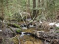
Fleißenbach in the upper reaches

on the border with Bad Brambach

first bridge over the Fleißenbach in the spa gardens of Bad Brambach


particularities
Between Milhostov and Vackovec located in the marshy river valley, the Mofette Bublák whose carbon dioxide emissions for measurements to determine the cause for the frequent earthquake swarms in since 2000 Vogtland was used.
South of the hamlet of Vackovec, the embankment of an unfinished Reichsautobahntrasse from the 1940s crosses the valley.
Tributaries and estuaries
- Sorgebach (r), below the group of houses Röthenbach
- Hohendorfer Bach (r), west of Bad Brambach train station
- Černý potok / Schwarz-Bach (r) with its tributary Forstbach, in the hamlet of Hammer
- Saugrundbach (Rokytnik) with the tributaries Rákosina, Rohrbach and Pstruhový potok (Hennebach) (l), below Lomnička
- Lubinka (Schönbach) (l), below Lesná