Valence-Chabeuil airport
| Aéroport de Valence-Chabeuil | ||
|---|---|---|
|
|
||
| Characteristics | ||
| ICAO code | LFLU | |
| IATA code | VAF | |
| Coordinates | ||
| Height above MSL | 160 m (525 ft ) | |
| Transport links | ||
| Distance from the city center | 5 km east of Valence | |
| Street |
D 68 2 km to the N 7 |
|
| Basic data | ||
| opening | 1930s | |
| operator | Syndicate Mixte de Gestion | |
| Start-and runway | ||
| 01/19 | 2100 m × 45 m asphalt | |
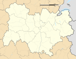
The Aéroport de Valence-Chabeuil is a French airport . It lies in the region of Auvergne Rhône-Alpes in the department of Drôme about five kilometers east of the center of Valence in the field of community Chabeuil .
Today it is mainly used for general aviation and is the location of several suppliers to the aviation industry. In addition, the army aviators of the French land forces maintain a center of around 400 men for testing their aircraft, the Groupement Aéromobilité de la Section Technique de l'Armée de Terre (GAMSTAT). All new types of helicopters in the French army are tested here.
history
The airport was a military airfield of the Armée de l'air before and during the Second World War . Since the 1930s, the Base aérienne de Valence-Chabeuil has been, among other things, a base for various flying groups and regional headquarters for operations in the Alpine region.
After the armistice in June 1940, the airborne units moved to French North Africa and the base was closed.
After the occupation of Vichy France by the German Wehrmacht , the airfield was a base of the Air Force and was until September 1943 base of May Hs 126 -Aufklärern and DFS 230 - gliders of III. Air landing squadron 1 group (III./LLG 1). During this time the 12th season moved to Italy for a short time and was used in the liberation of Mussolini from Gran Sasso .
Another unit was Kampfgeschwader 26, equipped with Ju 88A bombers . Initially, the II. Group (II./KG 26) was here between May and August 1944 and in August 1944 the staff and III. Group (S. and III./KG 26) added.
After the Allied invasion of southern France in August 1944, the airfield became a base of the Twelfth Air Force of the United States Army Air Forces (USAAF) under the Allied code name Airfield Y.23 . In September 1944, the 79th Fighter Group with its P-47 and the 111th Tactical Reconaissance Squadron and in September / October 1944 the 23rd Photo Reconaissance Squadron were located here . It was later used by American C-47 transport aircraft.
After the war, the airport again became a base for the French air force for a few years. The military use was later continued by the French army aviators. From September 1967, the airfield is the location of the test site for helicopters, then known as the Groupe d'expérimentation de l'aviation légère de l'armée de terre (GE ALAT). This became the Groupement de l'aviation légère de l'armée de l'armée de terre (GALAT) in 1972 and finally the Groupement aéromobilité de la section technique de l'armée de terre (GAMSTAT) in 1987.
From 1955 its civilian use began mainly for air freight traffic and a modest civil passenger air traffic began in the 1960s, the line to Paris was opened in 1969. In the following year, a 1800 m long concrete runway was built, which was extended by 300 m in 1972. A passenger terminal was also built.
As a result of the start of high-speed rail traffic by the French state railways, the first TGV route was established between Paris and Lyon in 1981, the importance of the airport increased.
After 2007, the Drôme Department invested 4.5 million euros, in particular to relocate aeronautical suppliers and to modernize the facilities for flight operations themselves.
