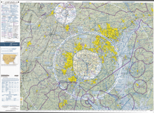
Aeronautical chart


Aeronautical charts (often simply called flight charts ) are an important basis for planning flight routes and for in- flight navigation . The map projection and the most important contents are regulated internationally by the ICAO ; however, the exact layout or the type of representation of the terrain and forest are left to the respective state.
The most common maps for visual flight and for detailed flight planning are overview maps in the scales of 1: 500,000 and 1: 1 million as well as in true-to-angle cone projection . But there are also larger-scale maps for slower general aviation aircraft and for gliding in many areas, such as the general aviation map of Germany on a scale of 1: 200,000.
The overprint, for which the responsible air traffic control agency - in Germany DFS Deutsche Flugsicherung GmbH - is responsible, is created anew every year, while the stored topographic map can remain the same for a long time. The imprint of the air traffic control is in blue and contains, among other things, all airways , the airspace structure , airfields as well as the radio beacons with name, frequency and Morse code, especially rotary radio beacons (VOR), DME , non-directional radio beacons (NDB) and markers of the runways .
In addition, the ICAO “map annex” prescribes a coordinate grid in a uniform reference system , the representation of larger towns, terrestrial traffic routes and bodies of water , as well as information on magnetic declination ( declination ).
ICAO maps on a scale of 1: 500,000 show control zones ( airspace D ) as pink-colored areas. The height information for the upper limit refers to sea level ( MSL ). The addition HX indicates that the zones are only temporarily active. The local traffic areas ( areas of airspace E ) are now generally outlined in blue.
The DFS German Air Traffic Control provides the aeronautical charts for instrument flights (IFR) in Germany and visual flights (VFR) in Germany and other European countries to. The latter under the name Airfield Guide.
Another provider of aeronautical charts is the traditional Jeppesen company , which was the world's first flight ticket publisher and is now part of the Boeing Group. Maps for instrument flight (without terrain display) are offered under the name Jeppesen and maps for visual flight under the names Bottlang (Airfield Manual) and Jeppesen (VFR + GPS Charts).
Large airlines often have their own departments that are responsible for producing all the map material required for their flight operations. Sometimes such departments are outsourced; This is the case, for example, with Lufthansa Systems AG , whose product is called "Lido".
Web links
- Digitized aeronautical charts of the US aviation authority FAA Download (for free public domain )
- ICAO Switzerland 1: 500,000 aeronautical map from the FOCA ( as a layer on map.geo.admin.ch ); associated map legend
