Fründenhütte
| Fründenhütte SAC refuge |
||
|---|---|---|
|
Fründenhütte towards Fründenjoch and Doldenhorn on the far right |
||
| location | to Mittelchnubel on the Fründen Glacier; Canton of Bern , Switzerland ; Valley location: Kandersteg | |
| Mountain range | Bernese Alps | |
| Geographical location: | 623 292 / 148 065 | |
| Altitude | 2562 m above sea level M. | |
|
|
||
| owner | SAC section Altels | |
| Built | 1936 | |
| Construction type | Refuge; stone | |
| Development | Mountain hiking trail | |
| Usual opening times | Opened from June to September | |
| accommodation | 70 beds | |
| Winter room | Yes | |
| Web link | Site of the hut | |
| Hut directory | SAC | |
The Fründenhütte is a refuge of the Swiss Alpine Club (SAC) of the Altels section. It is located in the municipality of Kandersteg in the canton of Bern in Switzerland .
Geographical location
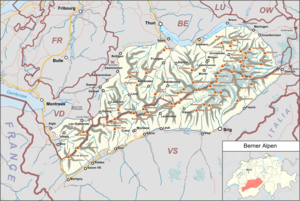
The hut is located on a rock pulpit (Mittelknubel) above the Fründen Glacier in the Bernese Alps, which was still surrounded by the glacier on both sides when the hut was built in 1936 . To the north of the hut is the Fründen Glacier, and to the south, 1000 meters lower, is the Oeschinensee . The Galletgrat begins to the south-west up to the Doldenhorn , to the south-east lies the hut's namesake, the Fründenhorn .
Hüttenweg
The hut can usually be reached from Kandersteg (train station) in around 4 hours (approx. 1400 meters difference in altitude). The path first leads to Oeschinensee - but you can also use the gondola to get to the lake - along the right bank of the lake, the hut path leads along a forest and soon reaches the tree line. The hut trail is a mountain trail and is signposted white-red-white. Due to the risk of landslides, however, this route has been closed since November 2019 until further notice.
Another, alpine approach route is the Fründenschnur , which traverses the rear rock face of the Oeschinensee. The name comes from the fact that the path, seen from the Oeschinensee, runs on a narrow strip of grass - a string. This path leads from Oeschinensee to Berghaus Underbärgli, where the path branches off in a southerly direction. The path leads further east over the Oeschinensee to the normal hut trail. A longer section of the route over the Oeschinensee is very exposed, which requires surefootedness and a head for heights. The path is secured with steel cables and is considered a T4 hiking trail.
history
The first attempt to build a hut on the Mittelknubel goes back to 1921; the project was rejected by the delegates' assembly of the SAC in Baden. The driving force behind the project, the founder and president of the Altels section, Hans Biehly, a doctor from Kandersteg, died in an accident. A second application was also rejected by the section. At the third attempt it finally worked, and in 1936 the first Fründenhütte could be inaugurated, under the first hut warden Fritz Ogi.
The hut not only served as a starting point for mountain tours in the direction of Fründenhorn, Doldenhorn and Blümlisalpmassiv , but also as an independent destination. In 1963, the number of beds was doubled through interior work, later the kitchen was expanded and the bedroom was separated from the lounge. As the number of overnight stays rose steadily, an extension was built in 1969 and inaugurated in the same year. Over the years, the expectations of the guests increased; The hut was expanded in the summer of 1992 and inaugurated in the autumn.
The Fründen Glacier, which still surrounded the hut in 1990, has retreated considerably in recent years. This caused problems with the water supply. Today the water supply comes from a naturally formed glacial lake and from extended water tanks.
Tours
From the Fründenhütte there are no further mountain hikes, only high-altitude tours such as the Fründenhorn or an alternative to the normal ascent via the Doldenhornhütte to the Doldenhorn over the Galletgrat, known as the Eisgrat by alpinists. As the firn fields and glaciers melt away, the routes are becoming increasingly difficult. The transition towards Oeschinenhorn is now an abseil point; many games are described as delicate. Even the most harmless-sounding transition over the Fründenjoch is demanding.
Web links
- Ruedi Rösti, former Kandersteg senior teacher and mayor, made a professional film in 1936 about the construction of the Fründenhütte ( PDF )
Individual evidence
- ↑ Archive link ( Memento of the original from July 7, 2011 in the Internet Archive ) Info: The archive link was inserted automatically and has not yet been checked. Please check the original and archive link according to the instructions and then remove this notice. .
- ↑ Fründenhorn from Fründenjoch on hikr.org
- ↑ Doldenhorn via Galletgrat on hikr.org
- ↑ Descent from Oeschinenhorn to Fründenhütte on hikr.org
- Jump over from Fründenjoch to hikr.org


