Franklin Island (Antarctica)
| Franklin Island | ||
|---|---|---|
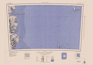
| Franklin Island in the northeastern part of the map sheet | ||
| Waters | Ross Sea ( Southern Ocean ) | |
| Geographical location | 76 ° 5 ′ S , 168 ° 19 ′ E | |
|
|
||
| length | 12.4 km | |
| width | 3.9 km | |
| surface | 33 km² | |
| Highest elevation | 310 m | |
| Residents | uninhabited | |
The Franklin Island ( English : Franklin Iceland ) is an island in the Antarctic Ross Sea . It is approximately 12 km long and is located north of Ross Island and Beaufort Island and east of McMurdo Sound .
The island is of volcanic origin and formed in the Pliocene . Rock samples taken from the lower 100 meters of the island show an age of 3.3-3.7 million years.
James Clark Ross landed on the island on January 27, 1841 and named it after John Franklin , the governor of Van Diemens Land ( Tasmania ).
There is an Adelie penguin breeding colony (about 60,000 pairs) on the island , which BirdLife International has designated as an Important Bird Area (AQ190). Between 1,500 and 5,000 pairs of emperor penguins breed on the sea ice east of Bernacchi Head , a rugged cliff at the extreme southern end of the island (Important Bird Area AQ189).
Web links
- Franklin Island in the Global Volcanism Program of the Smithsonian Institution (English).
- Antarctica Detail - Franklin Island in the Geographic Names Information System of the United States Geological Survey .
- Franklin Island, Antarctica. In: Geographical Names . Geographic.org (English).
Individual evidence
- ^ Sarah E. Rilling et al .: New determinations of 40 Ar / 39 Ar isotopic ages and flow volumes for Cenozoic volcanism in the Terror Rift, Ross Sea, Antarctica . In: Journal of Geophysical Research : Solid Earth . tape 114 , B12, December 2009, p. 2156–2202 , doi : 10.1029 / 2009JB006303 (English).
- ↑ Franklin Island southwest (AQ190) , datasheet on BirdLife International's website, accessed July 23, 2018.
- ↑ Bernacchi Head, Franklin Island (AQ189) , data sheet on the BirdLife International website, accessed July 23, 2018.

