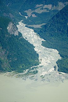
Franklin River (Knight Inlet)
| Franklin River | ||
|
Mouth of the Franklin River |
||
| Data | ||
| location | British Columbia ( Canada ) | |
| River system | Franklin River | |
| origin |
Franklin Glacier 51 ° 14 ′ 3 ″ N , 125 ° 28 ′ 38 ″ W. |
|
| Source height | approx. 700 m | |
| muzzle |
Knight Inlet ( Pacific Ocean ) Coordinates: 51 ° 4 ′ 23 " N , 125 ° 34 ′ 40" W 51 ° 4 ′ 23 " N , 125 ° 34 ′ 40" W |
|
| Mouth height | 0 m | |
| Height difference | approx. 700 m | |
| Bottom slope | approx. 32 ‰ | |
| length | 22 km | |
| Catchment area | approx. 680 km² | |
| Left tributaries | Fissure Creek, Crevice Creek, Stanton Creek | |
The Franklin River is a tributary of the Knight Inlet in the southern Coast Mountains in British Columbia . It forms the outlet of the Franklin Glacier , which stretches across the south of the Mount Waddington massif . The river flows 22 km south-southwest and flows into the head end of Knight Inlet. The Franklin River falls from 700 m to sea level. From the left it takes up the rivers Fissure Creek , Crevice Creek , Stanton Creek . The Franklin River drains an area of approximately 680 km². To the west of the mouth of the Franklin River, the Klinaklini River flows into the Knight Inlet.
The Franklin River was named after Benjamin Franklin, one of the first European farmers in the region, who owned a property at the southern end of Tatla Lake and explored the Klinaklini River valley in a southerly direction in 1892.
Web links
- Franklin River . In: BC Geographical Names (English)
Individual evidence
- ^ Andrew Scott: The Encyclopedia of Raincoast Place Names: A Complete Reference to Coastal British Columbia . Harbor Publishing, Madeira Park, BC 2009, ISBN 978-1-55017-484-7 , pp. 207 (English).
