Freetown, Massachusetts
| Freetown | ||
|---|---|---|
|
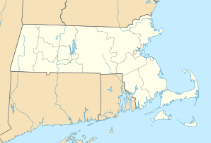
Location in Massachusetts
|
||
| Basic data | ||
| Foundation : | 1659 | |
| State : | United States | |
| State : | Massachusetts | |
| County : | Bristol County | |
| Coordinates : | 41 ° 46 ′ N , 71 ° 2 ′ W | |
| Time zone : | Eastern ( UTC − 5 / −4 ) | |
| Residents : | 8,472 (as of: 2000) | |
| Population density : | 89.4 inhabitants per km 2 | |
| Area : | 99.2 km 2 (approx. 38 mi 2 ) of which 94.8 km 2 (approx. 37 mi 2 ) is land |
|
| Height : | 50 m | |
| Postcodes : | 02702, 02717 | |
| Area code : | +1 508, 774 | |
| FIPS : | 25-25240 | |
| GNIS ID : | 0619434 | |
| Website : | www.town.freetown.ma.us | |
Freetown is a place in Bristol County in the US state Massachusetts with 8472 inhabitants (US Census in 2000).
Freetown is one of the oldest municipalities in the United States. The first settlers there were the Pilgrim Fathers and their descendants in the second half of the 17th century. The city originally included the place Fall River (1659-1803) and parts of Acushnet (1659-1815). In 1983 the place celebrated its three hundredth anniversary.
Freetown is divided into two localities, which historically have developed largely independently of one another: Assonet and East Freetown .
history
The first white settlers came to Freetown on the banks of the Assonet River on April 2, 1659. They had acquired the area from the Wampanoagindians . The population grew slowly. It was part of Plymouth Colony until the colony merged with the Massachusetts Bay Colony in 1685 . In 1774 the town of East Freetown was acquired by the town of Tiverton .
Residents of the city fought in the so-called King Philip's War 1675/1676 against the Wampanoag and during the American War of Independence it came here on May 28, 1775 for the "Battle of Freetown".
In 1803 Fall River separated from Freetown and in 1815 part of the village of Fairhaven was incorporated.
From the 18th to the early 20th century there was a lot of industrial production (blast furnaces, textiles, fishing) in Freetown, but this mostly did not last long here, so that the place mainly retained its rural character. One of the better known companies was the rifle manufacturer NR Davis & Sons, whose weapons were used in the American Civil War .
There are two national memorial sites in Freetown that have made it into the " National Register of Historic Places ": the "Assonet Village Historic District" and the "East Freetown Historic District".
City government
Freetown is ruled in the traditional style of the New England states by a " Board of Selectmen ". An institution that evolved from the traditional direct democracy of the region with assemblies of the adult population. The “chosen ones” regulate the daily business of the community between these meetings, which take place every year.
Attractions
Profile Rock, in the Freetown-Fall River State Forest , is a granite rock that, according to the local Wampanoag Indians, represents the face of their “chief” ( Obersachem ) Massasoit from King Philip's War. King Philip's Cave, in East Freetown, is said to have been a Metacomet ("King Philip") hideout during King Philip's War .
Literature on Freetown
- A History of the Town of Freetown, Massachusetts with an Account of the Old Home Festival, July 30th, 1902. Assonet Village Improvement Society 1902.
- Earl William Rogers, II: A Lexicon History of Freetown, Massachusetts. 1973.
- David T. Sullivan: Freetown in the Revolution . 1974.
- Earl William Rogers, II, Mark Andrew Ashton: Freetown: A Tri-Centennial Sampler. 1983.
- Helen Gurney Thomas: Vital Records of the Town of Freetown, Massachusetts, 1686 Through 1890. 1988, ISBN 1-55613-136-4 .
- Civil War Diaries of Major John M. Deane, Medal of Honor Winner, 1861–1865. , 2005.

