
Münster freight bypass railway
| Münster freight bypass railway | |||||||||||||||||||||||||||||||||||||||||||||||||||||||||||||||||||||||||
|---|---|---|---|---|---|---|---|---|---|---|---|---|---|---|---|---|---|---|---|---|---|---|---|---|---|---|---|---|---|---|---|---|---|---|---|---|---|---|---|---|---|---|---|---|---|---|---|---|---|---|---|---|---|---|---|---|---|---|---|---|---|---|---|---|---|---|---|---|---|---|---|---|---|
 | |||||||||||||||||||||||||||||||||||||||||||||||||||||||||||||||||||||||||
| Route number (DB) : | 2010 (Sudmühle – Mecklenbeck) 2011 (Canal – Lechtenberg) |
||||||||||||||||||||||||||||||||||||||||||||||||||||||||||||||||||||||||
| Course book section (DB) : | % (only GV) | ||||||||||||||||||||||||||||||||||||||||||||||||||||||||||||||||||||||||
| Route length: | 13 km | ||||||||||||||||||||||||||||||||||||||||||||||||||||||||||||||||||||||||
| Gauge : | 1435 mm ( standard gauge ) | ||||||||||||||||||||||||||||||||||||||||||||||||||||||||||||||||||||||||
| Power system : | 15 kV 16.7 Hz ~ | ||||||||||||||||||||||||||||||||||||||||||||||||||||||||||||||||||||||||
| Top speed: | 80 km / h | ||||||||||||||||||||||||||||||||||||||||||||||||||||||||||||||||||||||||
|
|||||||||||||||||||||||||||||||||||||||||||||||||||||||||||||||||||||||||
The Münster freight bypass line is an electrified and predominantly single-track bypass line in Münster in Westphalia , which is only used for freight traffic in order to carry it around the main train station in Münster , but freight trains to and from Rheine have to pass the train station in Münster.
history
It was opened on October 5, 1930, making it the youngest major railway construction project in the Münsterland .
The reason for the construction of the bypass was the sharp increase in freight traffic after the First World War in connection with the fact that Münster Central Station had no pure through tracks for goods trains and that they could not be built due to a lack of space.
Originally, the planning also envisaged the construction of a two-sided marshalling yard (e.g. in the area between Dortmund-Ems Canal and Kaldenhofer Weg), which was to be connected to all important routes leading to Münster via the bypass railway. For cost reasons, however, only the bypass was implemented.
Some structural features still bear witness to the original plans. Examples of this are the railway embankment designed for two tracks, the very wide embankment embankment in the area of the planned marshalling yard and bridge abutments that have never been used .
On May 25, 1968, the electrification of the line was completed.
Due to the planned relocation of goods traffic on the North Sea ports – Ruhr area to other routes via Minden as part of the Netz 21 project, the bypass line is not intended to be shut down immediately due to the lack of expansion there.
course
The bypass line begins at the Mecklenbeck depot on the Wanne-Eickel - Münster line . It runs east around the city center and joins the Münster - Osnabrück line at the Sudmühle station . In addition, the Lechtenberg junction gives you the option of using the bypass line in the direction of Sudmühle (or vice versa) from the Hamm - Münster route.
For the most part, the bypass line classified as the main line is single-track. Only the connecting curve to the Hammer route and the section of the transfer point (Üst) Pracht - Bbf Sudmühle are two-pronged. The Bbf Kanal has three station tracks.
The route is completely free of intersections, mostly built on an embankment. Only in the section between the Mecklenburg station and the Canal station is it partially in a cut.
There are many bridges along the route, of which the one over the Dortmund-Ems Canal is the largest.
literature
- Anja Gussek-Revermann, Heinz Kilian: Münster and the railway. From the beginning to the reconstruction after the Second World War. Ardey-Verlag, Münster 2003, ISBN 3-87023-183-1 ( Small writings from the Münster City Archives 6).
- Heinz Kilian, Christian Hübschen: Relief for the taxiway . In: Railway history. No. 13 (Dec. 2005 / Jan. 2006), pp. 10-22.
Web links
NRWbahnarchiv by André Joost:
Historical official maps:
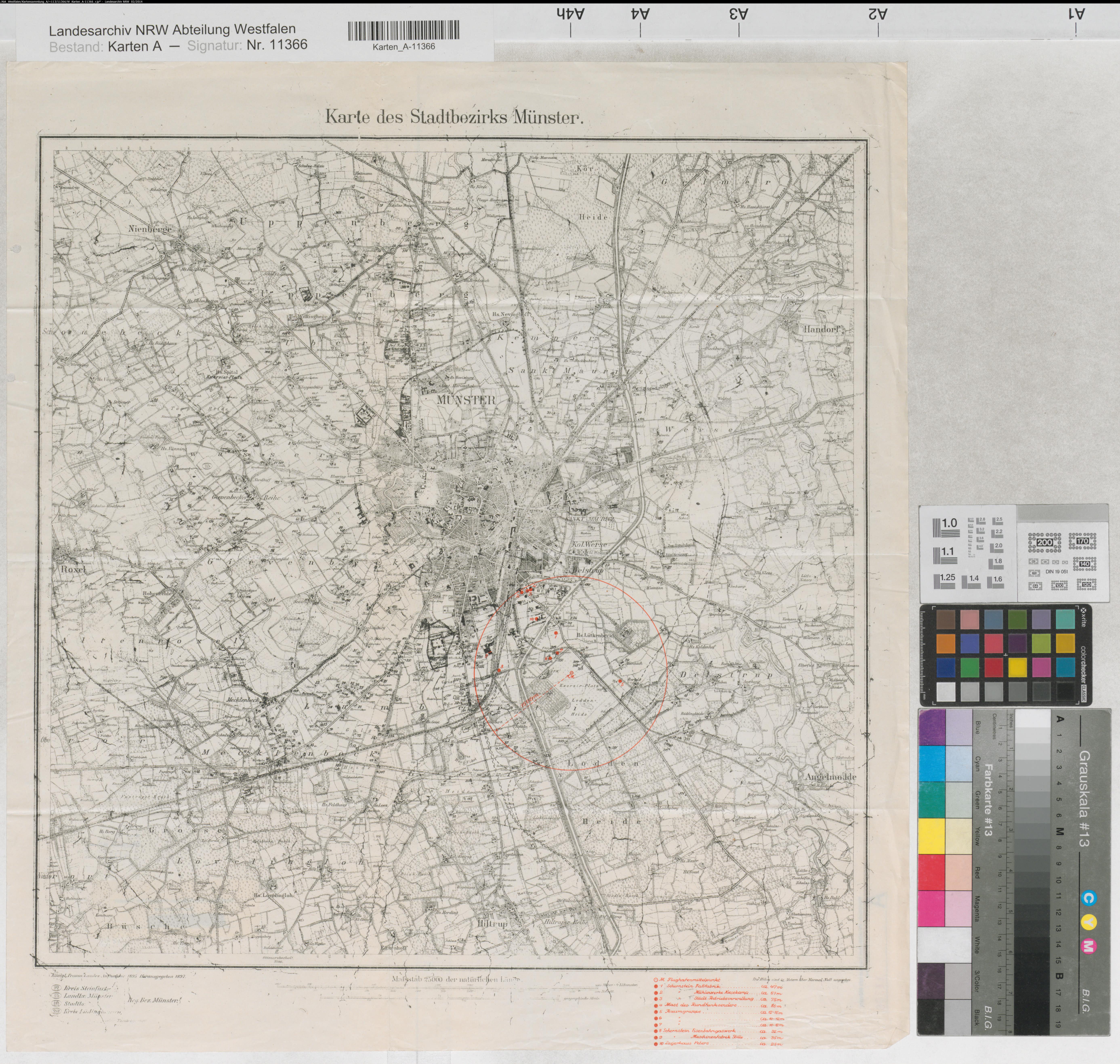
- Measuring table sheet 1922/1927
-
Measuring table sheet 1922
Note: The train station, which is already referred to as the "shunting yard" in the two maps above, never existed! - Measuring table sheet special edition beginning XX. Century with broken new building projects including marshalling yard area
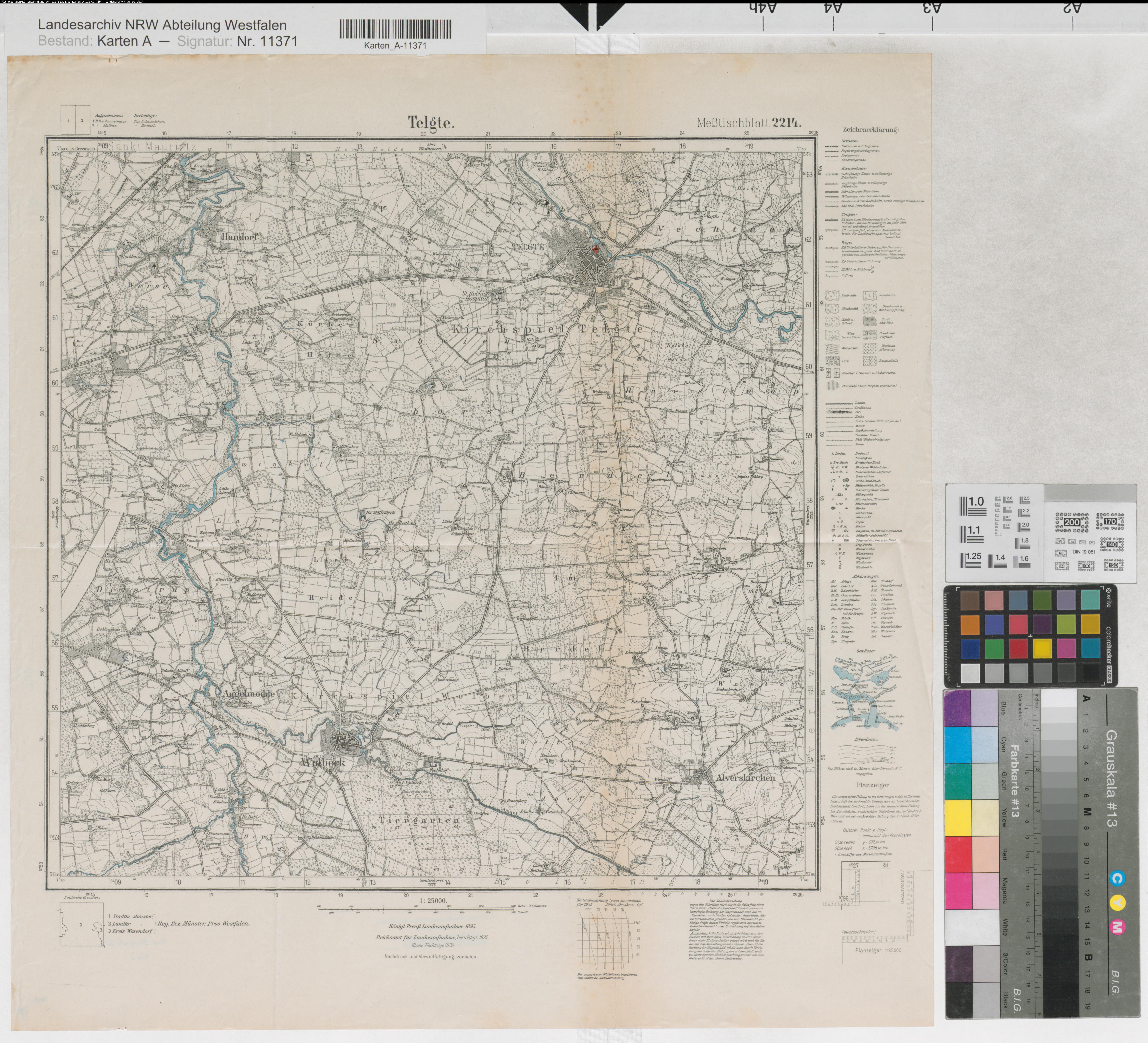
- Measuring table sheet Telgte with a railway area not realized in this way
- Hansa aerial photo of the railway area raised up for the south-north direction group in 1968, but there are no station tracks
Individual evidence
- ^ Anja Gussek-Revermann, Heinz Kilian: Münster and the railway . Ardey-Verlag 2003, p. 121
- ↑ DB Netze - Infrastructure Register
- ↑ Railway Atlas Germany . 9th edition. Schweers + Wall, Aachen 2014, ISBN 978-3-89494-145-1 .